Achriesgill
Achriesgill
| |
|---|---|
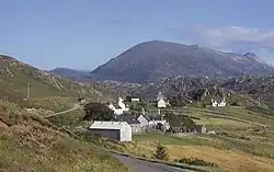 Eastern part of Achriesgill | |
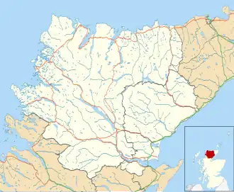 Achriesgill Location within the Sutherland area | |
| OS grid reference | NC254545 |
| Council area | |
| Country | Scotland |
| Sovereign state | United Kingdom |
| Postcode district | IV27 4 |
| Police | Scotland |
| Fire | Scottish |
| Ambulance | Scottish |
| UK Parliament | |
| Scottish Parliament | |
Achriesgill (Scottish Gaelic: Achadh Rìdhisgil)[1] is a village that lies on the eastern bank of Loch Inchard in Lairg, Sutherland, in the Scottish council area of Highland.[2] The village is on the road to Kinlochbervie.
In 1945, a documentary on the Scottish agricultural tradition of crofting called Crofters was released, which was both filmed in and featured Achriesgill.[3]
References
- ^ Microsoft; Nokia. "Achriesgill" (Map). Bing Maps. Microsoft. Retrieved 27 February 2017.
- ^ Ordnance Survey: Landranger map sheet 9 Cape Wrath (Durness & Scourie) (Map). Ordnance Survey. 2008. ISBN 9780319231234.
- ^ Full video at "Crofters". National Library for Scotland: Moving Image Archive catalogue. Retrieved 4 December 2023. NB Note from 04:00 mention of the "far away crofts, down by Sheigra and Oldshoremore": literally at the end of the road.