Agapur
Agapur | |
|---|---|
Village in Bihar | |
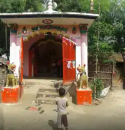 Raja Salesh Mandir, Agapur | |
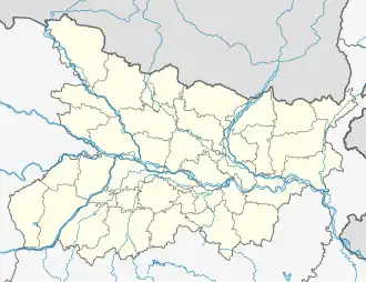 Agapur Location in Bihar, India  Agapur Agapur (India) | |
| Coordinates: 25°36′51″N 85°56′59″E / 25.6143°N 85.9496°E | |
| Country | |
| State | Bihar |
| District | Begusarai |
| Block | Mansurchak |
| Government | |
| • Type | Gram Panchayat |
| • Body | Agapur |
| Area | |
• Total | 2.15 km2 (0.83 sq mi) |
| Elevation | 49 m (161 ft) |
| Population (2011) | |
• Total | 3,338 |
| • Density | 1,600/km2 (4,000/sq mi) |
| Languages | |
| • Spoken | Maithili, Hindi, Urdu language, and English |
| Time zone | UTC+5:30 (IST) |
| PIN | 851128 |
| Vehicle registration | BR-09 |
| Website | begusarai |
Agapur is a village in Begusarai district, in the state of Bihar, India.[1]
Demographics
The village is home to 3338 people, among them 1738 (52%) are male and 1600 (48%) are female. 46% of the whole population are from general caste, 54% are from schedule caste. The child (aged under 6 years) population of Agapur village is 20%, among them 52% are boys and 48% are girls. There are 670 households in the village.[1]
References
- ^ a b "Census of India 2011". Office of the Registrar General & Census Commissioner, India. Retrieved 17 December 2018.