Agios Konstantinos, Phthiotis
Agios Konstantinos
Άγιος Κωνσταντίνος | |
|---|---|
 Agios Konstantinos Location within the regional unit 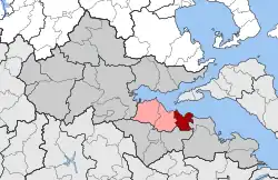 | |
| Coordinates: 38°45′N 22°52′E / 38.750°N 22.867°E | |
| Country | Greece |
| Administrative region | Central Greece |
| Regional unit | Phthiotis |
| Municipality | Kamena Vourla |
| Area | |
| • Municipal unit | 72.29 km2 (27.91 sq mi) |
| Population (2021)[1] | |
| • Municipal unit | 2,952 |
| • Municipal unit density | 41/km2 (110/sq mi) |
| • Community | 2,786 |
| Time zone | UTC+2 (EET) |
| • Summer (DST) | UTC+3 (EEST) |
| Vehicle registration | ΜΙ |
Agios Konstantinos (Greek: Άγιος Κωνσταντίνος) is a town and former municipality in Phthiotida (Phthiotis), Greece. After the 2011 administrative division reforms it became part of the municipality of Kamena Vourla and it is now ranked as a municipal unit,[2] with an area of 72.292 km2.[3] Its population was 2,952 in 2021.
The town has a harbor with a regular ferry-boat connection to the islands of Skiathos, Skopelos and Alonnisos.[4] These islands are part of the Northern Sporades archipelago.
References
- ^ "Αποτελέσματα Απογραφής Πληθυσμού - Κατοικιών 2021, Μόνιμος Πληθυσμός κατά οικισμό" [Results of the 2021 Population - Housing Census, Permanent population by settlement] (in Greek). Hellenic Statistical Authority. 29 March 2024.
- ^ "ΦΕΚ B 1292/2010, Kallikratis reform municipalities" (in Greek). Government Gazette.
- ^ "Population & housing census 2001 (incl. area and average elevation)" (PDF) (in Greek). National Statistical Service of Greece. Archived (PDF) from the original on 2015-09-21.
- ^ "Region by Destination". Archived from the original on 2011-08-15. Retrieved 2011-08-28.