Agios Vasileios, Achaea
Agios Vasileios
Άγιος Βασίλειος | |
|---|---|
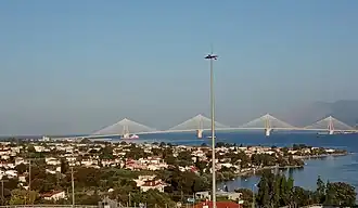 View of Agios Vasileios from the nearby hills | |
 Agios Vasileios | |
| Coordinates: 38°19′N 21°49′E / 38.317°N 21.817°E | |
| Country | Greece |
| Administrative region | Western Greece |
| Regional unit | Achaea |
| Municipality | Patras |
| Municipal unit | Rio |
| Elevation | 15 m (49 ft) |
| Population (2021)[1] | |
• Community | 2,889 |
| Time zone | UTC+2 (EET) |
| • Summer (DST) | UTC+3 (EEST) |
| Postal code | 265 00 |
| Vehicle registration | AX |
Agios Vasileios (Greek: Άγιος Βασίλειος) is a coastal village in the municipal unit of Rio, in the municipality of Patras. It is located on the Gulf of Corinth, 3 km northeast of Rio, Greece. The Greek National Road 8A (Patras - Corinth) passes south of the village.
Historical population
| Year | Population |
|---|---|
| 1981 | 640 |
| 1991 | 1,491 |
| 2001 | 2,045 |
| 2011 | 2,662 |
| 2021 | 2,889 |
See also
Gallery

References
- ^ "Αποτελέσματα Απογραφής Πληθυσμού - Κατοικιών 2021, Μόνιμος Πληθυσμός κατά οικισμό" [Results of the 2021 Population - Housing Census, Permanent population by settlement] (in Greek). Hellenic Statistical Authority. 29 March 2024.