Agout
| Agout | |
|---|---|
 | |
.png) | |
| Location | |
| Country | France |
| Physical characteristics | |
| Source | |
| • location | Massif Central |
| Mouth | |
• location | Tarn |
• coordinates | 43°47′4″N 1°41′1″E / 43.78444°N 1.68361°E |
| Length | 194.4 km (120.8 mi) |
| Basin size | 3,500 km2 (1,400 sq mi) |
| Discharge | |
| • average | 55 m3/s (1,900 cu ft/s) |
| Basin features | |
| Progression | Tarn→ Garonne→ Gironde estuary→ Atlantic Ocean |
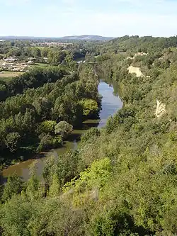
The Agout or Agoût (French pronunciation: [aɡu(t)]; Occitan: Agot) is a 194.4-kilometre (120.8 mi) long river in south-western France. It is a left tributary of the Tarn.[1] Its source is in the southern Massif Central, in the Haut-Languedoc Regional Nature Park. It flows generally west through the following department and towns:
The Agout flows into the Tarn at Saint-Sulpice.
Among its tributaries are the Dadou, the Gijou and the Thoré.

_Maisons_sur_l'Ago%C3%BBt_vues_du_pont_Neuf_vers_le_pont_Henri_Sizaire.jpg)

_-_La_chauss%C3%A9e_du_moulin_sur_l'Agout.jpg)
References
Wikimedia Commons has media related to Agout.