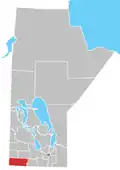
Rural Municipality of Albert
The Rural Municipality of Albert is a former rural municipality (RM) in the Canadian province of Manitoba. It was originally incorporated as a rural municipality on December 1, 1905.[1] It ceased on January 1, 2015 as a result of its provincially mandated amalgamation with the RM of Arthur and the RM of Edward to form the Municipality of Two Borders.[2]
It had a population of 339 in the 2006 census and was located in the Westman Region of the province.
This primarily agricultural municipality was formed in 1905 by a subdivision of the Rural Municipality of Arthur. The new entity was named after Albert Edward, Prince of Wales (later King Edward VII).
The population declined by 11.3% from 2001 to 2006. It had a land area of 769.55 square kilometres and ranked 3,544th in terms of population in Canada prior to amalgamation. It was located directly east of Manitoba's border with Saskatchewan.
Climate
| Climate data for Pierson (19 km south of the RM of Albert) | |||||||||||||
|---|---|---|---|---|---|---|---|---|---|---|---|---|---|
| Month | Jan | Feb | Mar | Apr | May | Jun | Jul | Aug | Sep | Oct | Nov | Dec | Year |
| Record high °C (°F) | 8.9 (48.0) |
17.5 (63.5) |
23.9 (75.0) |
34 (93) |
39.4 (102.9) |
41.7 (107.1) |
42.8 (109.0) |
40 (104) |
37.2 (99.0) |
33 (91) |
22.8 (73.0) |
17.2 (63.0) |
42.8 (109.0) |
| Mean daily maximum °C (°F) | −10.6 (12.9) |
−6.3 (20.7) |
−0.4 (31.3) |
11.3 (52.3) |
19.4 (66.9) |
23.8 (74.8) |
26.5 (79.7) |
26.2 (79.2) |
19.7 (67.5) |
11.9 (53.4) |
−0.1 (31.8) |
−8 (18) |
9.5 (49.1) |
| Mean daily minimum °C (°F) | −21.2 (−6.2) |
−16.5 (2.3) |
−9.8 (14.4) |
−1.8 (28.8) |
5.2 (41.4) |
10.1 (50.2) |
12.2 (54.0) |
10.9 (51.6) |
5.4 (41.7) |
−1.1 (30.0) |
−9.6 (14.7) |
−18 (0) |
−2.9 (26.8) |
| Record low °C (°F) | −44.4 (−47.9) |
−47.8 (−54.0) |
−45 (−49) |
−26.1 (−15.0) |
−12.2 (10.0) |
−6.1 (21.0) |
−2.2 (28.0) |
−6.1 (21.0) |
−12.2 (10.0) |
−22.2 (−8.0) |
−33.3 (−27.9) |
−42 (−44) |
−47.8 (−54.0) |
| Average precipitation mm (inches) | 22.6 (0.89) |
17.9 (0.70) |
21.7 (0.85) |
31.4 (1.24) |
54.7 (2.15) |
76.8 (3.02) |
67.6 (2.66) |
51.8 (2.04) |
46.8 (1.84) |
32.3 (1.27) |
21.9 (0.86) |
21.7 (0.85) |
467.2 (18.39) |
| Source: Environment Canada[3] | |||||||||||||
Communities
See also
References
- ^ "Manitoba's Municipal History: Rural Municipalities and Local Government Districts". The Manitoba Historical Society. September 21, 2014. Retrieved January 2, 2015.
- ^ "Manitoba's Municipal History: Municipal Amalgamations (2015)". The Manitoba Historical Society. December 1, 2014. Retrieved January 2, 2015.
- ^ Environment Canada—[1]. Retrieved 21 Nov 2012.
- Manitoba Municipalities: Rural Municipality of Albert
- Rural Municipality of Albert Population Data
- Pierson Climate Data
External links
Division No. 5, Manitoba (Southwest Manitoba) | ||||
|---|---|---|---|---|
| Towns |
|  | ||
| Villages |
| |||
| Rural municipalities |
| |||
| Unincorporated communities | ||||