Altofonte
Altofonte
Parcu (Sicilian) | |
|---|---|
| Comune di Altofonte | |
 | |
Location of Altofonte | |
 Altofonte Location of Altofonte in Italy 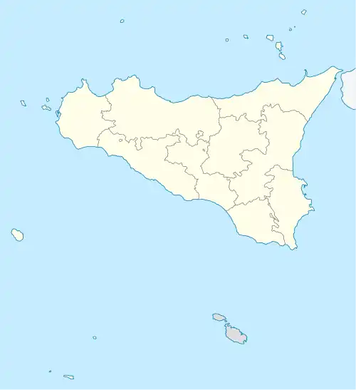 Altofonte Altofonte (Sicily) | |
| Coordinates: 38°2′41″N 13°17′55″E / 38.04472°N 13.29861°E | |
| Country | Italy |
| Region | Sicily |
| Metropolitan city | Palermo (PA) |
| Frazioni | Piano Maglio, Blandino |
| Government | |
| • Mayor | Angela De Luca |
| Area | |
• Total | 35 km2 (14 sq mi) |
| Elevation | 350 m (1,150 ft) |
| Population (31 December 2013)[2] | |
• Total | 10,378 |
| • Density | 300/km2 (770/sq mi) |
| Demonym | Altofontini or Parchitani |
| Time zone | UTC+1 (CET) |
| • Summer (DST) | UTC+2 (CEST) |
| Postal code | 90030 |
| Dialing code | 091 |
| Patron saint | St. Hanna |
| Saint day | 26 July |
| Website | Official website |
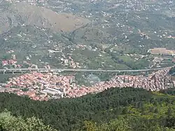
Altofonte (Sicilian: Parcu) is a comune (municipality) in the Metropolitan City of Palermo in the Italian region Sicily, located about 9 kilometres (6 mi) southwest of Palermo.
Altofonte borders the following municipalities: Belmonte Mezzagno, Monreale, Palermo, Piana degli Albanesi, San Giuseppe Jato.
Main sights
- Church of Santa Maria in Altofonte, built in 1633.
- Church of San Michele Arcangelo (early 12th century)
Demographic evolution

References
- ^ "Superficie di Comuni Province e Regioni italiane al 9 ottobre 2011". Italian National Institute of Statistics. Retrieved 16 March 2019.
- ^ All demographics and other statistics: Italian statistical institute Istat.
External links