Ambrault
Ambrault | |
|---|---|
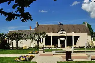 The town hall in Ambrault | |
Location of Ambrault | |
 Ambrault  Ambrault | |
| Coordinates: 46°47′00″N 1°58′00″E / 46.7833°N 1.966700°E | |
| Country | France |
| Region | Centre-Val de Loire |
| Department | Indre |
| Arrondissement | Issoudun |
| Canton | Ardentes |
| Intercommunality | Champagne Boischauts |
| Government | |
| • Mayor (2020–2026) | Étienne Aujard[1] |
Area 1 | 25.59 km2 (9.88 sq mi) |
| Population (2022)[2] | 887 |
| • Density | 35/km2 (90/sq mi) |
| Time zone | UTC+01:00 (CET) |
| • Summer (DST) | UTC+02:00 (CEST) |
| INSEE/Postal code | 36003 /36120 |
| Elevation | 143–1,206 m (469–3,957 ft) (avg. 168 m or 551 ft) |
| 1 French Land Register data, which excludes lakes, ponds, glaciers > 1 km2 (0.386 sq mi or 247 acres) and river estuaries. | |
Ambrault (French pronunciation: [ɑ̃bʁo]) is a commune in the Indre department in central France.
Population
| Year | Pop. | ±% p.a. |
|---|---|---|
| 1968 | 692 | — |
| 1975 | 614 | −1.69% |
| 1982 | 642 | +0.64% |
| 1990 | 669 | +0.52% |
| 1999 | 715 | +0.74% |
| 2009 | 891 | +2.23% |
| 2014 | 917 | +0.58% |
| 2020 | 890 | −0.50% |
| Source: INSEE[3] | ||
See also
References
- ^ "Répertoire national des élus: les maires" (in French). data.gouv.fr, Plateforme ouverte des données publiques françaises. 13 September 2022.
- ^ "Populations de référence 2022" (in French). The National Institute of Statistics and Economic Studies. 19 December 2024.
- ^ Population en historique depuis 1968, INSEE
Wikimedia Commons has media related to Ambrault.