Arc (Provence)
| Arc | |
|---|---|
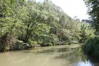 The Arc flowing near Aix-en-Provence | |
 Location of mouth 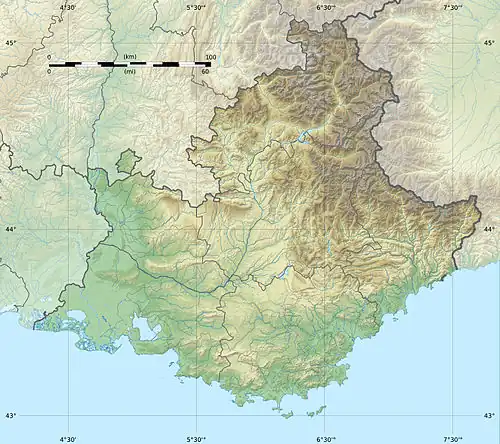 Arc (Provence) (Provence-Alpes-Côte d'Azur) | |
| Location | |
| Country | France |
| Physical characteristics | |
| Source | |
| • location | Pourcieux |
| • elevation | 470 m (1,540 ft) |
| Mouth | Étang de Berre |
• coordinates | 43°30′24″N 5°6′49″E / 43.50667°N 5.11361°E |
| Length | 83 km (52 mi) |
| Basin size | 716 km2 (276 sq mi) |
| Basin features | |
| Progression | Étang de Berre→ Mediterranean Sea |
The Arc (French pronunciation: [aʁk] ⓘ) is an 83-kilometre (52 mi) long river in Southern France.[1] It arises at an elevation of 470 metres (1,540 ft), close to the village of Pourcieux. It then passes through Aix-en-Provence before flowing into the Étang de Berre, a lagoon connected with the Mediterranean Sea to the west of Marseille. Its drainage basin, with a surface area of 716 square kilometres (276 sq mi), is divided between two departments, Var and Bouches-du-Rhône.[2] The Bayeux, the Cause and the Torse are its tributaries.
The Roquefavour Aqueduct passes over the river; Paul Cézanne's Mont Sainte-Victoire and the Viaduct of the Arc River Valley is the best known piece of art representing the Arc.
References
- ^ Sandre. "Fiche cours d'eau - L'Arc (Y4--0200)".
- ^ Bassin versant : Arc (L'), Observatoire Régional Eau et Milieux Aquatiques en PACA