Ascensión de Guarayos
Ascensión de Guarayos | |
|---|---|
Town | |
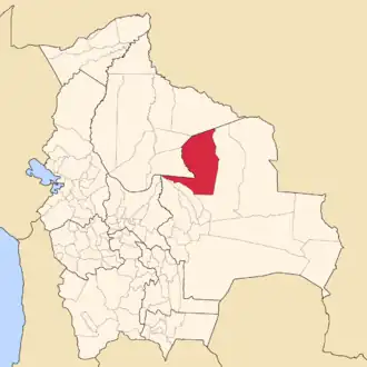
 Ascensión de Guarayos Ascensión de Guarayos as shown on the country map of Bolivia. | |
| Coordinates: 15°53′32″S 63°11′17″W / 15.89222°S 63.18806°W | |
| Country | |
| Department | Santa Cruz Department |
| Province | Guarayos Province |
| Municipality | Ascensión de Guarayos Municipality |
| Elevation | 827 ft (252 m) |
| Population (2010) | |
• Total | 18,816 |
| Time zone | UTC-4 (BOT) |
| Climate | Aw |
| Website | https://web.archive.org/web/20101129173824/http://www.guarayos.gob.bo/ |
Ascensión de Guarayos is a town in Bolivia. In 2010 it had an estimated population of 18,816.[1]
The town is served by Ascensión de Guarayos Airport.
Climate
| Climate data for Ascensión de Guarayos, elevation 247 m (810 ft) | |||||||||||||
|---|---|---|---|---|---|---|---|---|---|---|---|---|---|
| Month | Jan | Feb | Mar | Apr | May | Jun | Jul | Aug | Sep | Oct | Nov | Dec | Year |
| Record high °C (°F) | 36.8 (98.2) |
36.7 (98.1) |
36.5 (97.7) |
36.4 (97.5) |
36.8 (98.2) |
33.9 (93.0) |
35.1 (95.2) |
38.4 (101.1) |
38.6 (101.5) |
40.4 (104.7) |
38.8 (101.8) |
39.5 (103.1) |
40.4 (104.7) |
| Mean daily maximum °C (°F) | 31.0 (87.8) |
30.7 (87.3) |
30.9 (87.6) |
30.3 (86.5) |
28.1 (82.6) |
27.7 (81.9) |
28.3 (82.9) |
30.7 (87.3) |
31.9 (89.4) |
32.7 (90.9) |
32.0 (89.6) |
31.2 (88.2) |
30.5 (86.8) |
| Daily mean °C (°F) | 26.6 (79.9) |
26.2 (79.2) |
26.2 (79.2) |
25.3 (77.5) |
23.0 (73.4) |
22.2 (72.0) |
21.8 (71.2) |
23.6 (74.5) |
25.4 (77.7) |
27.0 (80.6) |
26.9 (80.4) |
26.7 (80.1) |
25.1 (77.1) |
| Mean daily minimum °C (°F) | 22.2 (72.0) |
21.8 (71.2) |
21.5 (70.7) |
20.2 (68.4) |
18.0 (64.4) |
16.6 (61.9) |
15.3 (59.5) |
16.6 (61.9) |
18.9 (66.0) |
21.2 (70.2) |
21.8 (71.2) |
22.2 (72.0) |
19.7 (67.5) |
| Record low °C (°F) | 13.6 (56.5) |
14.5 (58.1) |
10.2 (50.4) |
10.7 (51.3) |
6.0 (42.8) |
4.7 (40.5) |
4.5 (40.1) |
4.0 (39.2) |
7.8 (46.0) |
12.7 (54.9) |
11.4 (52.5) |
13.4 (56.1) |
4.0 (39.2) |
| Average precipitation mm (inches) | 215.9 (8.50) |
194.8 (7.67) |
158.3 (6.23) |
70.6 (2.78) |
66.0 (2.60) |
39.9 (1.57) |
28.2 (1.11) |
36.5 (1.44) |
52.3 (2.06) |
89.7 (3.53) |
159.7 (6.29) |
192.3 (7.57) |
1,304.2 (51.35) |
| Average precipitation days | 12.8 | 12.0 | 10.7 | 6.0 | 5.3 | 2.8 | 2.3 | 2.4 | 3.7 | 6.4 | 8.6 | 11.7 | 84.7 |
| Average relative humidity (%) | 84.6 | 85.8 | 85.4 | 83.3 | 81.8 | 81.1 | 74.9 | 69.2 | 65.7 | 74.8 | 77.3 | 84.0 | 79.0 |
| Source: Servicio Nacional de Meteorología e Hidrología de Bolivia[2][3] | |||||||||||||
References
- ^ "World Gazetteer".
- ^ "Base de datos Sistema Meteorológico–SISMET" (in Spanish). Servicio Nacional de Meteorología e Hidrología de Bolivia. Archived from the original on 7 June 2018. Retrieved 12 June 2024.
- ^ "índices climáticos para 149 estaciones meteorológicas en Bolivia" (in Spanish). Servicio Nacional de Meteorología e Hidrología de Bolivia. Retrieved 12 June 2024.