Aspach, Upper Austria
Aspach | |
|---|---|
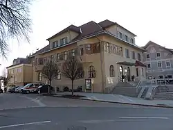 Aspach town hall | |
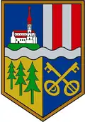 Coat of arms | |
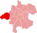
 Aspach Location within Austria | |
| Coordinates: 48°11′10″N 13°18′20″E / 48.18611°N 13.30556°E | |
| Country | Austria |
| State | Upper Austria |
| District | Braunau am Inn |
| Government | |
| • Mayor | Karl Mandl (ÖVP) |
| Area | |
• Total | 31.46 km2 (12.15 sq mi) |
| Elevation | 443 m (1,453 ft) |
| Population (2018-01-01)[2] | |
• Total | 2,596 |
| • Density | 83/km2 (210/sq mi) |
| Time zone | UTC+1 (CET) |
| • Summer (DST) | UTC+2 (CEST) |
| Postal code |
|
| Area code | 07755 |
| Vehicle registration | BR |
| Website | www.aspach.at |
Aspach (German pronunciation: [ˈaspax] ⓘ) is a municipality in the district Braunau am Inn in the Austrian state of Upper Austria.
Villages
(Inhabitants as 1 January 2020)
- Aichet (15)
- Aspach (871)
- Au (90)
- Baumgarten (32)
- Buchleiting (19)
- Döging (18)
- Dötting (19)
- Ecking (8)
- Eigelsberg (34)
- Eisecking (16)
- Englham (25)
- Hinterholz (128)
- Hobling (18)
- Kappeln (32)
- Kasing (40)
- Kasting (42)
- Katzlberg (8)
- Kleinschneidt (53)
- Leithen (29)
- Leithen am Walde (30)
- Maierhof (24)
- Migelsbach (74)
- Mitterberg (11)
- Naderling (9)
- Niederham (6)
- Offenschwandt (23)
- Parz (1)
- Pimberg (34)
- Ried (19)
- Roith (36)
- Rottersham (14)
- Steinberg (42)
- Teinsberg (11)
- Thal (14)
- Wasserdobl (38)
- Weißau (11)
- Wieselberg (26)
- Wildenau (693)
See also
References
- ^ "Dauersiedlungsraum der Gemeinden Politischen Bezirke und Bundesländer - Gebietsstand 1.1.2018". Statistics Austria. Retrieved 10 March 2019.
- ^ "Einwohnerzahl 1.1.2018 nach Gemeinden mit Status, Gebietsstand 1.1.2018". Statistics Austria. Retrieved 9 March 2019.
Wikimedia Commons has media related to Aspach, Upper Austria.
Places adjacent to Aspach, Upper Austria | |
|---|---|