Atacazo
| Atacazo | |
|---|---|
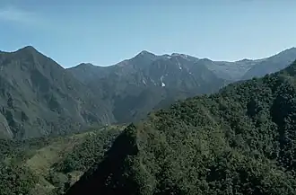 Atacazo viewed from the other side | |
| Highest point | |
| Elevation | 4,463 m (14,642 ft) |
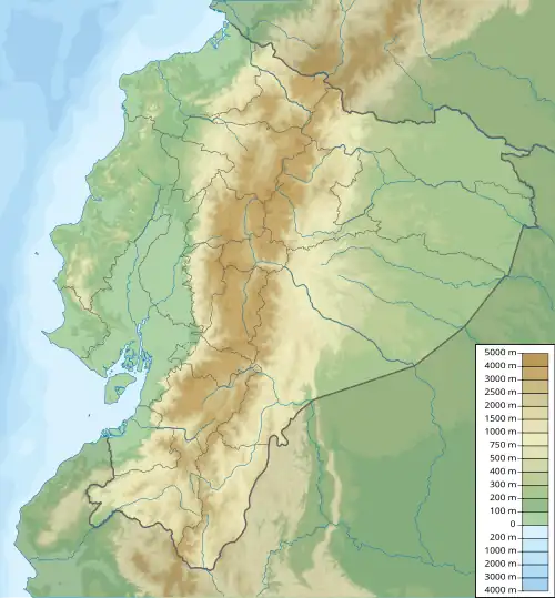
| Coordinates | 0°21′10″S 78°37′01″W / 0.35278°S 78.61694°W |
| Geography | |
 Atacazo | |
| Parent range | Andes |
| Geology | |
| Mountain type | Stratovolcano |
| Last eruption | 320 BCE ± 16 years |
Atacazo is a volcano of the Western Cordillera located 25 kilometers southwest of Quito, Ecuador. Atacazo is a stratovolcano formed by the action of a Late-Pleistocene to Holocene caldera.[1] The last eruption of the Atacazo was nearly 2300 years ago.
Aerial tragedy
On November 7, 1960 a Fairchild F-27 turboprop passenger plane, operated by the now-defunct national airline AREA Ecuador, struck the Atacazo in bad weather during its approach to the newly-inaugurated Mariscal Sucre International Airport after a flight from Simón Bolívar International Airport, in Guayaquil.[2][3] The crash, 16 kilometres (9.9 mi) south of Quito and 150 meters to the summit of the Atacazo, killed all the 37 occupants of the plane.[4] At the time, it was the worst aerial crash in the history of Ecuador, the first and worst fatal loss of an F-27 passenger plane, and the first accident involving the then-recently-opened Quito airport.[5][6]
See also
References
- ^ "Atacazo". Global Volcanism Program. Smithsonian Institution. Retrieved 2021-06-29.
- ^ "Los momentos tristes del aeropuerto Mariscal Sucre".
- ^ "Lost Schemes: #294 AREA-Ecuador DC-7C (1968) – Airlinercafe".
- ^ "Accident Fairchild F-27A HC-ADV, Monday 7 November 1960".
- ^ "Los momentos tristes del aeropuerto Mariscal Sucre".
- ^ "Accident Fairchild F-27A HC-ADV, Monday 7 November 1960".