Bábolna
Bábolna | |
|---|---|
 Flag 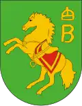 Coat of arms | |
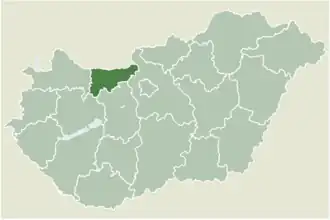 Location of Komárom-Esztergom county in Hungary | |
 Bábolna Location of Bábolna | |
| Coordinates: 47°38′34″N 17°58′43″E / 47.64282°N 17.97864°E | |
| Country | |
| Region | Central Transdanubia |
| County | Komárom-Esztergom |
| District | Komárom |
| Area | |
• Total | 33.59 km2 (12.97 sq mi) |
| Population (2015)[1] | |
• Total | 3,789 |
| • Density | 110/km2 (290/sq mi) |
| Time zone | UTC+1 (CET) |
| • Summer (DST) | UTC+2 (CEST) |
| Postal code | 2943 |
| Area code | (+36) 34 |
| Motorways | M1 |
| Distance from Budapest | 98.8 km (61.4 mi) East |
| Website | www |
Bábolna is a town in Komárom-Esztergom county, Hungary.
Bábolna houses a riding school, Pettko-Szandtner Tibor Lovas Szakiskola es Kollegium Archived 2021-06-16 at the Wayback Machine and a stud farm.
References
- ^ Gazetteer of Hungary, 1st January 2015. Hungarian Central Statistical Office.
External links
Wikimedia Commons has media related to Bábolna.
- Official website in Hungarian
- (in Hungarian) Street map
| Towns (3) | ||
|---|---|---|
| Large village (1) | ||
| Villages (5) | ||
| City with county rights | 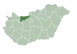  | |
|---|---|---|
| Towns | ||
| Large villages | ||
| Villages |
| |
| Other topics |
| |