Baars, Overijssel
Baars | |
|---|---|
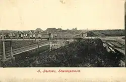 Bridge over the railway near Baars (1913-1918) | |
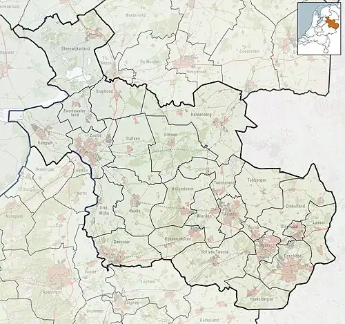 Baars Location in the Netherlands  Baars Baars (Netherlands) | |
| Coordinates: 52°48′50″N 6°05′14″E / 52.8139°N 6.0873°E | |
| Country | Netherlands |
| Province | Overijssel |
| Municipality | Steenwijkerland |
| Area | |
• Total | 2.12 km2 (0.82 sq mi) |
| Elevation | 13 m (43 ft) |
| Population (2021)[1] | |
• Total | 85 |
| • Density | 40/km2 (100/sq mi) |
| Time zone | UTC+1 (CET) |
| • Summer (DST) | UTC+2 (CEST) |
| Postal code | 8336[1] |
| Dialing code | 0521 |
| Website | WittePaardenBaars.nl |
Baars is a hamlet in the Dutch province of Overijssel. It is located in the municipality Steenwijkerland, about 4 km northwest of the town of Steenwijk.
It was first mentioned in 1340 as Baersdijc, and refers to a farm named Baers which is the Dutch word for the European perch.[3] It is a statistical entity,[1] and has its own postal code.[4] It used to have place name signs, but they have been removed again. The hamlet shares resources with neighbouring Witte Paarden.[5]
References
- ^ a b c d "Kerncijfers wijken en buurten 2021". Central Bureau of Statistics. Retrieved 17 March 2022.
- ^ "Postcodetool for 8336KH". Actueel Hoogtebestand Nederland (in Dutch). Het Waterschapshuis. Archived from the original on 21 September 2013. Retrieved 16 March 2022.
- ^ "Baars - (geografische naam)". Etymologiebank (in Dutch). Retrieved 17 March 2022.
- ^ "Postcode 8336 in Baars". Postcode bij adres (in Dutch). Retrieved 17 March 2022.
- ^ "Baars". Plaatsengids (in Dutch). Retrieved 17 March 2022.
External links
- Official website with Witte Paarden (in Dutch)