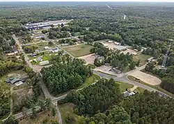
Babcock, Wisconsin
Babcock, Wisconsin | |
|---|---|
Census-designated place | |
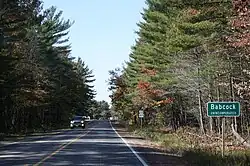 Sign on WIS 173 | |
 Babcock, Wisconsin | |
| Coordinates: 44°18′06″N 90°06′40″W / 44.30167°N 90.11111°W | |
| Country | United States |
| State | Wisconsin |
| County | Wood |
| Area | |
• Total | 3.101 sq mi (8.03 km2) |
| • Land | 3.101 sq mi (8.03 km2) |
| • Water | 0 sq mi (0 km2) |
| Elevation | 974 ft (297 m) |
| Population | |
• Total | 122 |
| • Density | 39/sq mi (15/km2) |
| Time zone | UTC-6 (Central (CST)) |
| • Summer (DST) | UTC-5 (CDT) |
| ZIP code | 54413 |
| Area codes | 715 & 534 |
| GNIS feature ID | 1561050[2] |
Babcock is an census-designated place located in Wood County, Wisconsin, United States. Babcock is southwest of Wisconsin Rapids, in the town of Remington. Babcock has a post office with ZIP code 54413.[3] As of the 2010 census, its population is 126.[4] Its motto is "Birds, Bogs, and Bucks." The community was named for Joseph W. Babcock, a sawmill operator who purchased the site and built a hotel and a depot.[5][6]
Babcock was once an important junction on the Milwaukee Road, with lines running north, east, south, and southwest. Today, however, only a single track of the Canadian National runs south to Necedah and east to Port Edwards and Wisconsin Rapids.
Images
-
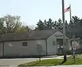 Post office
 -
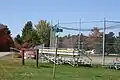 Baseball diamond
 -
See also
References
- ^ "Census Bureau profile: Babcock CDP, Wisconsin". United States Census Bureau. May 2023. Retrieved May 13, 2025.
- ^ U.S. Geological Survey Geographic Names Information System: Babcock, Wisconsin
- ^ ZIP Code Lookup
- ^ "U.S. Census website". U.S. Census Bureau. Retrieved March 29, 2011.
- ^ Callary, Edward (2016). Place Names of Wisconsin. Madison, WI: University of Wisconsin Press. p. 18. ISBN 978-0-299-30964-0.
- ^ Rudolph, Robert S. (1970). Wood County Place Names. The University of Wisconsin Press. p. 6.
External links
Wikimedia Commons has media related to Babcock, Wisconsin.
Municipalities and communities of Wood County, Wisconsin, United States | ||
|---|---|---|
| Cities |  | |
| Villages | ||
| Towns | ||
| CDPs | ||
| Other communities | ||
| Indian reservation | ||
| Footnotes | ‡This populated place also has portions in an adjacent county or counties | |