Baijiantan, Karamay
Baijiantan
白碱滩区 • جەرەنبۇلاق رايونى | |
|---|---|
 Baijiantan in Karamay | |
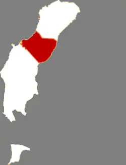
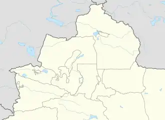 Baijiantan Location of the seat in Xinjiang 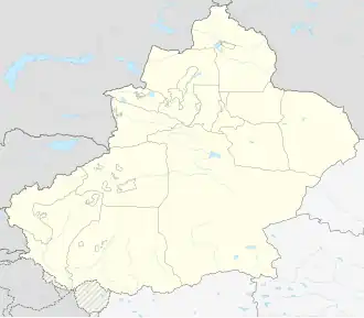 Baijiantan Baijiantan (Xinjiang) 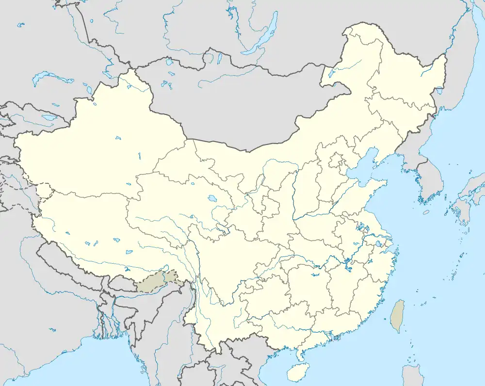 Baijiantan Baijiantan (China) | |
| Coordinates: 45°38′N 85°11′E / 45.633°N 85.183°E | |
| Country | China |
| Autonomous region | Xinjiang |
| Prefecture-level city | Karamay |
| District seat | Zhongxing Road Subdistrict |
| Area | |
• Total | 1,268 km2 (490 sq mi) |
| Population (2020)[1] | |
• Total | 50,825 |
| • Density | 40/km2 (100/sq mi) |
| Time zone | UTC+8 (China Standard[a]) |
| Website | www |
| Baijiantan, Karamay | |||||||||||
|---|---|---|---|---|---|---|---|---|---|---|---|
| Chinese name | |||||||||||
| Simplified Chinese | 白碱滩区 | ||||||||||
| Traditional Chinese | 白鹼灘區 | ||||||||||
| |||||||||||
| Uyghur name | |||||||||||
| Uyghur | جەرەنبۇلاق رايونى | ||||||||||
| |||||||||||
Baijiantan District (Chinese: 白碱滩区; Uyghur: جەرەنبۇلاق رايونى) is a district of the city of Karamay in the Xinjiang Uyghur Autonomous Region. It contains an area of 1,272 km2 (491 sq mi). According to the 2002 census, it has a population of 60,000.
Administrative divisions
Baijiantan District contains 3 subdistricts:
| Name | Simplified Chinese | Hanyu Pinyin | Uyghur (UEY) | Uyghur Latin (ULY) | Administrative division code | |
|---|---|---|---|---|---|---|
| Subdistricts | ||||||
| Zhongxing Road Subdistrict | 中兴路街道 | Zhōngxīnglù Jiēdào | مەركىزىي ئاۋات يولى كوچا باشقارمىسى | Merkiziy Awat yoli kocha bashqarmisi | 650204001 | |
| Sanping Road Subdistrict | 三平路街道 | Sānpínglù Jiēdào | سەنپىڭ يولى كوچا باشقارمىسى | Senping yoli kocha bashqarmisi | 650204002 | |
| Jinlongzhen Subdistrict | 金龙镇街道 | Jīnlóngzhèn Jiēdào | جىنلۇڭ بازىرى كوچا باشقارمىسى | Jinlung baziri kocha bashqarmisi | 650204003 | |
Transport
Notes
- ^ Locals in Xinjiang frequently observe UTC+6 (Xinjiang Time), 2 hours behind Beijing.
References