Bamna Upazila
Bamna
বামনা | |
|---|---|
.svg.png) | |
| Coordinates: 22°18.1′N 90°6′E / 22.3017°N 90.100°E | |
| Country | |
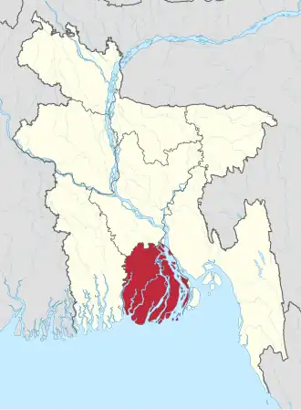
| Division | Barisal Division |
| District | Barguna District |
| Area | |
• Total | 101.05 km2 (39.02 sq mi) |
| Population | |
• Total | 78,942 |
| • Density | 780/km2 (2,000/sq mi) |
| Time zone | UTC+6 (BST) |
| Postal code | 8730[2] |
| Website | Official Map of the Bamna Upazila |
Bamna (Bengali: বামনা) is an upazila of Barguna District in Barisal, Bangladesh.[3]
Demographics
| Year | Pop. (000) | ±% |
|---|---|---|
| 1981 | 64 | — |
| 1991 | 66 | +3.1% |
| 2001 | 70 | +6.1% |
| 2011 | 79 | +12.9% |
| 2022 | 78 | −1.3% |
| Source: Bangladesh Bureau of Statistics[4] | ||
According to the 2011 Census of Bangladesh, Bamna Upazila had a population of 79,564 living in 19,537 households. 17,529 (22.03%) were under 10 years of age. Bamna has a literacy rate (age 7 and over) of 61.1%, compared to the national average of 51.8%, and a sex ratio of 1,018 females per 1,000 males. 7,744 (9.73%) lived in urban areas.[6][7]
Administration
UNO: Md. Al Imran[8]
Bamna Upazila is divided into four union parishads: Bamna, Bukabunia, Dauatola, and Ramna. The union parishads are subdivided into 39 mauzas and 49 villages.[4] Bamna also has one thana which is known as Bamna Thana.
Notable people
- Syed Rahmatur Rob Irtiza Ahsan (1935–2020), politician and fighter
- Khandaker Mahbub Hossain (1938–2022), politician and advocate
- Asmat Ali Sikder (1939–2001), politician and teacher
- Syed Qamarul Ahsan, politician and litterateur
See also
- Upazilas of Bangladesh
- Districts of Bangladesh
- Divisions of Bangladesh
- Administrative geography of Bangladesh
References
- ^ National Report (PDF). Population and Housing Census 2022. Vol. 1. Dhaka: Bangladesh Bureau of Statistics. November 2023. p. 395. ISBN 978-9844752016.
- ^ "Bangladesh Postal Code". Dhaka: Bangladesh Postal Department under the Department of Posts and Telecommunications of the Ministry of Posts, Telecommunications and Information Technology of the People's Republic of Bangladesh. 21 October 2024.
- ^ Sirajul Islam; Miah, Sajahan; Khanam, Mahfuza; Ahmed, Sabbir, eds. (2012). "Bamna Upazila". Banglapedia: the National Encyclopedia of Bangladesh (Online ed.). Dhaka, Bangladesh: Banglapedia Trust, Asiatic Society of Bangladesh. ISBN 984-32-0576-6. OCLC 52727562. OL 30677644M. Retrieved 17 August 2025.
- ^ a b "District Statistics 2011: Barguna" (PDF). Bangladesh Bureau of Statistics. Archived from the original (PDF) on 13 November 2014. Retrieved 14 July 2014.
- ^ Population and Housing Census 2022 - District Report: Barguna (PDF). District Series. Dhaka: Bangladesh Bureau of Statistics. June 2024. ISBN 978-984-475-223-8.
- ^ "Community Report: Barguna" (PDF). Bangladesh Bureau of Statistics. Retrieved 15 August 2018.
- ^ "Bangladesh Population & Housing Census-2011, Zila Report: Barguna" (PDF). Bangladesh Bureau of Statistics. p. 18.
- ^ উপজেলা নির্বাহী অফিসার. Barguna District. 26 August 2024. Archived from the original on 26 August 2024.
Capital: Barguna | ||
| Upazilas | ||
| Constituencies | ||
| Attractions and sites | ||
| History | ||
| Inhabited areas |
| |
| Educational institutions | ||
| Rivers and transport |
| |