Banský Studenec
Banský Studenec
Tópatak | |
|---|---|
 | |
 Flag | |
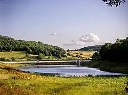
 Banský Studenec Location of Banský Studenec in the Banská Bystrica Region  Banský Studenec Location of Banský Studenec in Slovakia | |
| Coordinates: 48°27′N 18°59′E / 48.45°N 18.98°E | |
| Country | |
| Region | |
| District | Banská Štiavnica District |
| First mentioned | 1266 |
| Area | |
• Total | 19.20 km2 (7.41 sq mi) |
| Elevation | 570 m (1,870 ft) |
| Population (2021)[3] | |
• Total | 462 |
| Time zone | UTC+1 (CET) |
| • Summer (DST) | UTC+2 (CEST) |
| Postal code | 969 01[2] |
| Area code | +421 45[2] |
| Car plate | BS |
| Website | www |
Banský Studenec (German: Kohlbach, Goldbach; Hungarian: Tópatak) is a village and municipality in the Banská Štiavnica District, in the Banská Bystrica Region of Slovakia.
History
In historical records, the village was first mentioned in 1266 (Kulpach) as a German settlement. It belonged to Banská Bystrica.
Genealogical resources
The records for genealogical research are available at the state archive in Banská Bystrica (Slovak: Štátny archív v Banskej Bystrici).
- Roman Catholic church records (births/marriages/deaths): 1788-1897 (parish A)
See also
References
- ^ "Hustota obyvateľstva - obce [om7014rr_ukaz: Rozloha (Štvorcový meter)]". www.statistics.sk (in Slovak). Statistical Office of the Slovak Republic. 2022-03-31. Retrieved 2022-03-31.
- ^ a b c "Základná charakteristika". www.statistics.sk (in Slovak). Statistical Office of the Slovak Republic. 2015-04-17. Retrieved 2022-03-31.
- ^ "Počet obyvateľov podľa pohlavia - obce (ročne)". www.statistics.sk (in Slovak). Statistical Office of the Slovak Republic. 2022-03-31. Retrieved 2022-03-31.
External links
Municipalities of Banská Štiavnica District | ||
|---|---|---|