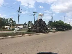
Baraguá
Baraguá | |
|---|---|
 Gaspar, Cuba | |
 Coat of arms | |
.png) Baraguá municipality (red) within Ciego de Ávila Province (yellow) and Cuba | |
| Coordinates: 21°40′55″N 78°37′28″W / 21.68194°N 78.62444°W | |
| Country | Cuba |
| Province | Ciego de Ávila |
| Seat | Gaspar |
| Area | |
• Total | 728 km2 (281 sq mi) |
| Elevation | 5 m (16 ft) |
| Population (2022)[2] | |
• Total | 31,361 |
| • Density | 43/km2 (110/sq mi) |
| Time zone | UTC-5 (EST) |
| Area code | +53-43 |
| Website | https://www.baragua.gob.cu/es/ |
Baraguá (Spanish pronunciation: [baɾaˈɣwa]) is a municipality and town in the Ciego de Ávila Province of Cuba. Its administrative seat is located in the town of Gaspar.[1]
Geography
The municipality occupies the south-eastern part of the province, and the area is dominated by mangrove.
Demographics
In 2022, the municipality of Baraguá had a population of 31,361.[2] With a total area of 728 km2 (281 sq mi),[1] it has a population density of 43/km2 (110/sq mi).
See also
References
- ^ a b c Statoids (July 2003). "Municipios of Cuba". Archived from the original on 12 October 2007. Retrieved 2007-10-06.
- ^ a b "Cuba: Administrative Division (Provinces and Municipalities) - Population Statistics, Charts and Map". www.citypopulation.de. Retrieved 2024-02-03.
External links
![]() Media related to Baraguá at Wikimedia Commons
Media related to Baraguá at Wikimedia Commons
Places adjacent to Baraguá | ||||||||||||||||
|---|---|---|---|---|---|---|---|---|---|---|---|---|---|---|---|---|
| ||||||||||||||||