Barguelonnette
| Barguelonnette | |
|---|---|
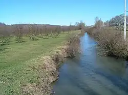 The Barguelonnette. | |
  | |
| Location | |
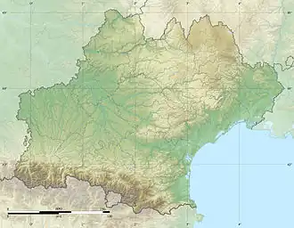
| Country | France |
| Physical characteristics | |
| Source | |
| • location | Villesèque |
| • coordinates | 44°23′20″N 01°20′19″E / 44.38889°N 1.33861°E |
| • elevation | 265 m (869 ft) |
| Mouth | Barguelonne |
• coordinates | 44°12′00″N 01°03′13″E / 44.20000°N 1.05361°E |
• elevation | 80 m (260 ft) |
| Length | 35.1 km (21.8 mi) |
| Basin features | |
| Progression | Barguelonne→ Garonne→ Gironde estuary→ Atlantic Ocean |
The Barguelonnette (French pronunciation: [baʁɡəlɔnɛt], also called Petite Barguelonne, literally Little Barguelonne) is a 35.1-kilometre-long (21.8 mi) river in the Lot and Tarn-et-Garonne départements, southwestern France.[1] Its source is at Villesèque. It flows generally southwest. It is a right tributary of the Barguelonne into which it flows between Montbarla and Montesquieu.
Départements and communes along its course
This list is ordered from source to mouth:
- Lot: Villesèque, Saint-Pantaléon, Saint-Daunès, Montcuq, Lebreil
- Tarn-et-Garonne: Sainte-Juliette, Bouloc, Lauzerte, Montagudet, Saint-Amans-de-Pellagal, Montbarla, Miramont-de-Quercy, Montesquieu,
References
Wikimedia Commons has media related to Barguelonnette.