Bathmen
Bathmen | |
|---|---|
![Landscape between Bathmen and Harfsen [nl]](./_assets_/Tussen_Bathmen_en_Harfsen%252C_de_Dorther_Beek_2012-09-09_10.56.jpg) Landscape between Bathmen and Harfsen | |
 Flag  Coat of arms | |
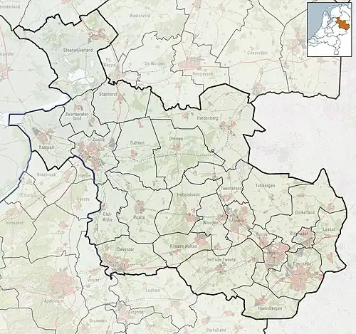 Bathmen Location in the Netherlands  Bathmen Bathmen (Netherlands) | |
| Coordinates: 52°15′0″N 6°17′13″E / 52.25000°N 6.28694°E | |
| Country | Netherlands |
| Province | |
| Municipality | Deventer |
| Area | |
• Total | 31.99 km2 (12.35 sq mi) |
| Elevation | 10 m (30 ft) |
| Population (2021)[1] | |
• Total | 5,815 |
| • Density | 180/km2 (470/sq mi) |
| Time zone | UTC+1 (CET) |
| • Summer (DST) | UTC+2 (CEST) |
| Postal code | 7437[1] |
| Dialing code | 0570 |
| Website | postcards of Bathmen |
Bathmen is a village and former municipality in the east of the Netherlands. The municipality was merged with her larger neighbour of Deventer on 1 January 2005 as part of a national effort to reduce bureaucracy in the country. Its main population centres were Apenhuizen, Bathmen, Dortherhoek, Loo, Pieriksmars and Zuidloo.[3]
It was first mentioned in 1284 as Batmen. The etymology is unclear.[4] In 1840, it was home to 1,507 people. In 1997, Deventer tried to annex Bathmen, but failed.[3]
Gallery
-
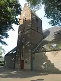 Church in Bathmen
 -
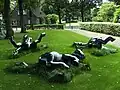 Rolling horses statue by Esther de Jong
 -
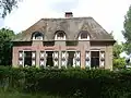 House in Bathmen
 -
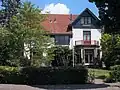 Villa Macamalo
References
- ^ a b c "Kerncijfers wijken en buurten 2021". Central Bureau of Statistics. Retrieved 18 March 2022.
- ^ "Postcodetool for 7437AA". Actueel Hoogtebestand Nederland (in Dutch). Het Waterschapshuis. Archived from the original on 21 September 2013. Retrieved 18 March 2022.
- ^ a b "Bathmen". Plaatsengids (in Dutch). Retrieved 18 March 2022.
- ^ "Bathmen - (geografische naam)". Etymologiebank (in Dutch). Retrieved 18 March 2022.
External links
![]() Media related to Bathmen at Wikimedia Commons
Media related to Bathmen at Wikimedia Commons