Batiaghata Upazila
Batiaghata
বটিয়াঘাটা | |
|---|---|
 | |
.svg.png) | |
| Coordinates: 22°44.5′N 89°31′E / 22.7417°N 89.517°E | |
| Country | |
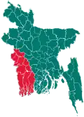
| Division | Khulna |
| District | Khulna |
| Area | |
• Total | 248.31 km2 (95.87 sq mi) |
| Population | |
• Total | 233,540 |
| • Density | 940/km2 (2,400/sq mi) |
| Time zone | UTC+6 (BST) |
| Postal code | 9260[2] |
| Website | Official Map of Batiaghata |
Batiaghata (Bengali: বটিয়াঘাটা) is an upazila of Khulna District in the Division of Khulna, Bangladesh.[3]
Geography
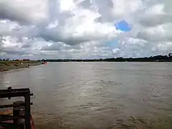
Batiaghata is located at 22°44′30″N 89°31′00″E / 22.7417°N 89.5167°E. The Kajibacha river divides it into an eastern and a western part.[3] It has 40779 households and total area 248.31 km2.
Demographics
As of the 2011 Census of Bangladesh, Batiaghata upazila had 40,779 households and a population of 171,691. 32,365 (18.85%) were under 10 years of age. Batiaghata had an average literacy rate of 54.90%, compared to the national average of 51.8%, and a sex ratio of 981 females per 1000 males. 7,675 (4.47%) of the population lived in urban areas.[5][6]
According to the 1991 Bangladesh census, Batiaghata had a population of 128184. Males constituted 51.07% of the population, and females 48.93%. The population aged 18 or over is 71,463. Batiaghata has an average literacy rate of 37.7% (7+ years), compared to the national average of 32.4%.[7]
Points of interest
- Baroaria Bazar
- Baintala Bazaar
- Pagol r Mandir
- Prem Kanon
- Batiaghata Bridge
- Gopalkhali Park
- Kazibacha River
- Batiaghata Bazaar
- Guptamari Gram
- Premkanon Family Picnic Corner
- Tamim Telecom Hatbati
- Shialidanga Bazar
Administration
Batiaghata Upazila is divided into seven union parishads: Amirpur, Baliadanga, Botiaghata, Gongarampur, Jolma, Surkhali, and Vandarkote. The union parishads are subdivided into 127 mauzas and 172 villages.[8]
Education
Primary schools
- Batiaghata Govt. Primary School
- Bayarbhanga Govt. Primary School
- Bayarbhanga Paschim Para Primary School
- Guptamary Govt. Primary School
- Chakrakhali Govt. Primary School
- Kashiadanga Govt. Primary School
- Khalshibunia Govt. Primary School
- Maitvanga Govt. Primary school
- 44 no. K. Baintala Govt. Primary School
- Saleha begum govt primary School
- Hetalbunia Primary School
- Shialidanga Govt. Primary school
Secondary school
- Batiaghata Thana Head Quarters Pilot Model Secondary School
- Batiaghata High School
- Bayarbhanga Biswambhara High school
- Jolma Chokrakhali Secondary School
- Khalshibunia G.P.B. High School
- Kharabad Baintala High School
- Gaoghara High School
- Batiaghata Thana Head Quarters Girls High School
- Rashmohan Girls High School, Bayarbhanga
- B.L.G. High school
- Shialidanga secondary school
College
- Khagendranath Girls College
- Gariardanga Adarsha College
- Batiaghata Degree College
- Kharabad Baintala School & College
Nearest tourist points
- Shat Gombuj Mosque
- Sundarban
- Mongla Port
- Khulna City
- Shitala Bari Temple
- Chandramohol
See also
References
- ^ National Report (PDF). Population and Housing Census 2022. Vol. 1. Dhaka: Bangladesh Bureau of Statistics. November 2023. p. 400. ISBN 978-9844752016.
- ^ "Bangladesh Postal Code". Dhaka: Bangladesh Postal Department under the Department of Posts and Telecommunications of the Ministry of Posts, Telecommunications and Information Technology of the People's Republic of Bangladesh. 21 October 2024.
- ^ a b Shah Siddiq (2012), "Batiaghata Upazila", in Sirajul Islam and Ahmed A. Jamal (ed.), Banglapedia: National Encyclopedia of Bangladesh (Second ed.), Asiatic Society of Bangladesh
- ^ Population and Housing Census 2022 - District Report: Khulna (PDF). District Series. Dhaka: Bangladesh Bureau of Statistics. June 2024. ISBN 978-984-475-271-9. Archived from the original (PDF) on 2025-02-25. Retrieved 2024-10-16.
- ^ "Bangladesh Population and Housing Census 2011 Zila Report – Khulna" (PDF). bbs.gov.bd. Bangladesh Bureau of Statistics. Archived from the original (PDF) on 2023-12-11. Retrieved 2023-11-25.
- ^ "Community Tables: Khulna district" (PDF). bbs.gov.bd. Bangladesh Bureau of Statistics. 2011.
- ^ "Population Census Wing, BBS". Archived from the original on 2005-03-27. Retrieved November 10, 2006.
- ^ "District Statistics 2011: Khulna" (PDF). Bangladesh Bureau of Statistics. Archived from the original (PDF) on 13 November 2014. Retrieved 14 July 2014.
Capital: Khulna | ||
| Upazilas/thanas | ||
| Constituencies | ||
| Attractions and sites | ||
| Education | ||