Bayandelger, Sükhbaatar
Bayandelger District
Баяндэлгэр сум ᠪᠶ᠋ᠠᠨᠳᠡᠯᠭᠡᠷᠰᠤᠮᠤ | |
|---|---|
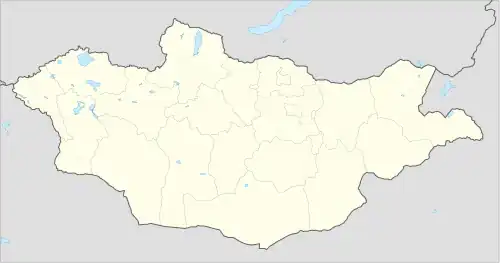 Bayandelger District Location in Mongolia | |
| Coordinates: 45°43′39″N 112°21′25″E / 45.72750°N 112.35694°E | |
| Country | Mongolia |
| Elevation | 1,110 m (3,645 ft) |
| Population (2009) | |
• Total | 4,569 |
| Time zone | UTC+8 |
Bayandelger (Mongolian: Баяндэлгэр, Rich expanse) is a sum (district) of Sükhbaatar Province in eastern Mongolia. The population (as of 2009) of the sum is 4,569, including 1,169 in the sum center.[2]
Climate
Bayandelger has a cold semi-arid climate (Köppen climate classification BSk) with warm summers and very cold winters. Most precipitation falls in the summer as rain. Winters are very dry.
| Climate data for Bayandelger, elevation 1,101 m (3,612 ft), (1991–2020 normals, extremes 1956–present) | |||||||||||||
|---|---|---|---|---|---|---|---|---|---|---|---|---|---|
| Month | Jan | Feb | Mar | Apr | May | Jun | Jul | Aug | Sep | Oct | Nov | Dec | Year |
| Record high °C (°F) | 2.2 (36.0) |
10.9 (51.6) |
22.5 (72.5) |
29.0 (84.2) |
36.0 (96.8) |
37.5 (99.5) |
39.4 (102.9) |
39.4 (102.9) |
35.2 (95.4) |
30.5 (86.9) |
15.1 (59.2) |
4.4 (39.9) |
39.4 (102.9) |
| Mean daily maximum °C (°F) | −13.3 (8.1) |
−8.1 (17.4) |
2.9 (37.2) |
12.6 (54.7) |
20.2 (68.4) |
25.8 (78.4) |
28.6 (83.5) |
26.9 (80.4) |
20.1 (68.2) |
10.2 (50.4) |
−2.0 (28.4) |
−11.9 (10.6) |
9.3 (48.8) |
| Daily mean °C (°F) | −18.5 (−1.3) |
−14.2 (6.4) |
−4.3 (24.3) |
5.4 (41.7) |
12.9 (55.2) |
19.3 (66.7) |
22.2 (72.0) |
20.2 (68.4) |
13.5 (56.3) |
3.8 (38.8) |
−7.9 (17.8) |
−16.8 (1.8) |
3.0 (37.3) |
| Mean daily minimum °C (°F) | −22.9 (−9.2) |
−19.3 (−2.7) |
−10.1 (13.8) |
−1.1 (30.0) |
6.0 (42.8) |
13.1 (55.6) |
16.2 (61.2) |
14.0 (57.2) |
7.3 (45.1) |
−1.9 (28.6) |
−12.6 (9.3) |
−21.0 (−5.8) |
−2.7 (27.2) |
| Record low °C (°F) | −37.8 (−36.0) |
−35.0 (−31.0) |
−33.9 (−29.0) |
−21.1 (−6.0) |
−8.0 (17.6) |
0.0 (32.0) |
1.1 (34.0) |
1.3 (34.3) |
−6.4 (20.5) |
−21.0 (−5.8) |
−30.5 (−22.9) |
−37.8 (−36.0) |
−37.8 (−36.0) |
| Average precipitation mm (inches) | 0.8 (0.03) |
1.2 (0.05) |
2.9 (0.11) |
7.9 (0.31) |
24.4 (0.96) |
34.1 (1.34) |
44.9 (1.77) |
27.8 (1.09) |
19.6 (0.77) |
6.9 (0.27) |
3.8 (0.15) |
1.9 (0.07) |
176.2 (6.92) |
| Average precipitation days (≥ 1.0 mm) | 0.2 | 0.5 | 1.0 | 1.7 | 3.7 | 4.8 | 6.7 | 4.6 | 3.1 | 1.6 | 1.0 | 0.7 | 29.6 |
| Source 1: NOAA[3]Starlings Roost Weather[4] | |||||||||||||
| Source 2: Meteo Climat (record highs and lows)[5] | |||||||||||||
Administrative divisions
The district is divided into six bags, which are:[6]
- Bayan
- Delger
- Dukhum
- Khongor
- Shireet
- Tuv
Notable natives
- Sanjiin Bataa, Minister of Defense (1952–1956)
References
- ^ "Bayandelger, Mongolia". Falling Rain Global Gazetteer. Retrieved 27 January 2013.
- ^ "Sükhbaatar Aimag Annual Statistical Report 2009". Archived from the original on April 21, 2012. Retrieved January 15, 2013.
- ^ "Bayandelger Climate Normals 1968-1990". National Oceanic and Atmospheric Administration (FTP). January 2023. Retrieved January 15, 2013. (To view documents see Help:FTP)
- ^ "BAYANDELGER Climate: 1991–2020". Starlings Roost Weather. Retrieved 3 January 2025.
- ^ "Station Bayandelger" (in French). Meteo Climat. August 2014. Retrieved 10 October 2018.
- ^ "Resident Population in Mongolia, by Bag/Khoroo". Mongolian Statistical Information Service. Retrieved 28 February 2025.