Bedidy
Bedidy | |
|---|---|
 Bedidy Location in Madagascar | |
| Coordinates: 17°28′S 48°1′E / 17.467°S 48.017°E | |
| Country | |
| Region | Alaotra-Mangoro |
| District | Amparafaravola |
| Elevation | 917 m (3,009 ft) |
| Population (2001)[2] | |
• Total | 10,000 |
| Time zone | UTC3 (EAT) |
| Postal code | 504 |
Bedidy is a rural municipality in Madagascar. It belongs to the district of Amparafaravola, which is a part of Alaotra-Mangoro Region. The population of the commune was estimated to be approximately 10,000 in 2001 commune census.[2]
Only primary schooling is available. The majority 99% of the population of the commune are farmers. The most important crop is rice, while other important products are maize and cassava. Services provide employment for 1% of the population.[2]
Geography
Bedidy is situated 46 km West of Amparafaravola to which it is linked by a unpaved piste.[3]
References
- ^ Estimated based on DEM data from Shuttle Radar Topography Mission
- ^ a b c "ILO census data". Cornell University. 2002. Retrieved 2008-03-24.
- ^ DEVELOPPEMENT SELON LA VISION INTERCOMMUNALE -Cas de la Com de la Commune Rurale Amparafaravola
Capital: Ambatondrazaka | ||
| Ambatondrazaka (21) | 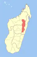 | |
| Amparafaravola (21) | ||
| Andilamena (8) | ||
| Anosibe An'ala (11) | ||
| Moramanga (22) | ||
5 districts; 82 communes | ||
17°28′S 48°1′E / 17.467°S 48.017°E