Bell Craig
| Bell Craig | |
|---|---|
 | |
| Highest point | |
| Elevation | 623 m (2,044 ft)[1] |
| Prominence | 47 m (154 ft)[2] |
| Listing | Tu,Sim,D,GT,DN[3] |
| Geography | |
| Location | Dumfries and Galloway, Scottish Borders, Scotland |
| Parent range | Ettrick Hills, Southern Uplands |
| OS grid | NT 18655 12860 |
| Topo map | OS Landranger 79 |
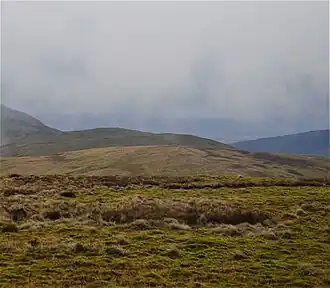
Bell Craig is a hill in the Ettrick Hills range, part of the Southern Uplands of Scotland. It is part of a ridge that runs parallel to the A708 road on its southern side, with White Coomb in the Moffat Hills directly opposite.[4] The northern slopes are designated as part of the 'Moffat Hills' SSSI and SAC - the summit marks a corner of the area.[5]
Subsidiary SMC Summits
| Summit | Height (m) | Listing[6] |
|---|---|---|
| Mid Rig | 615.8 | Tu,Sim,DT,GT,DN[7] |
References
- ^ "Bell Craig". www.hill-bagging.co.uk.
- ^ "Bell Craig".
- ^ "Database of British and Irish Hills: User guide".
- ^ "New Donalds Map". www.mountainsofscotland.co.uk.
- ^ "SiteLink". sitelink.nature.scot.
- ^ "Database of British and Irish Hills: User guide".
- ^ "Mid Rig".