Bezděkov pod Třemšínem
Bezděkov pod Třemšínem | |
|---|---|
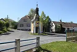 Chapel of the Holy Trinity | |
 Bezděkov pod Třemšínem Location in the Czech Republic | |
| Coordinates: 49°34′38″N 13°52′43″E / 49.57722°N 13.87861°E | |
| Country | |
| Region | Central Bohemian |
| District | Příbram |
| First mentioned | 1544 |
| Area | |
• Total | 3.63 km2 (1.40 sq mi) |
| Elevation | 550 m (1,800 ft) |
| Population (2025-01-01)[1] | |
• Total | 163 |
| • Density | 45/km2 (120/sq mi) |
| Time zone | UTC+1 (CET) |
| • Summer (DST) | UTC+2 (CEST) |
| Postal code | 262 42 |
| Website | www |
Bezděkov pod Třemšínem (until 1950 Bezděkov) is a municipality and village in Příbram District in the Central Bohemian Region of the Czech Republic. It has about 200 inhabitants.
Demographics
| Year | Pop. | ±% |
|---|---|---|
| 1869 | 304 | — |
| 1880 | 313 | +3.0% |
| 1890 | 299 | −4.5% |
| 1900 | 282 | −5.7% |
| 1910 | 275 | −2.5% |
| 1921 | 244 | −11.3% |
| 1930 | 229 | −6.1% |
| 1950 | 161 | −29.7% |
| 1961 | 153 | −5.0% |
| 1970 | 160 | +4.6% |
| 1980 | 174 | +8.7% |
| 1991 | 142 | −18.4% |
| 2001 | 143 | +0.7% |
| 2011 | 155 | +8.4% |
| 2021 | 155 | +0.0% |
| Source: Censuses[2][3] | ||
References
- ^ "Population of Municipalities – 1 January 2025". Czech Statistical Office. 2025-05-16.
- ^ "Historický lexikon obcí České republiky 1869–2011" (in Czech). Czech Statistical Office. 2015-12-21.
- ^ "Population Census 2021: Population by sex". Public Database. Czech Statistical Office. 2021-03-27.
External links
Wikimedia Commons has media related to Bezděkov pod Třemšínem.