Birkweiler
Birkweiler | |
|---|---|
 Coat of arms | |
Location of Birkweiler within Südliche Weinstraße district 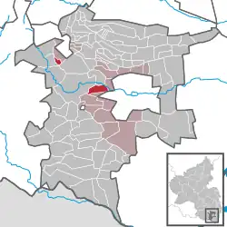 | |
 Birkweiler  Birkweiler | |
| Coordinates: 49°12′21″N 8°02′11″E / 49.20583°N 8.03639°E | |
| Country | Germany |
| State | Rhineland-Palatinate |
| District | Südliche Weinstraße |
| Municipal assoc. | Landau-Land |
| Government | |
| • Mayor (2019–24) | Bernd Flaxmeyer[1] |
| Area | |
• Total | 4.99 km2 (1.93 sq mi) |
| Elevation | 189 m (620 ft) |
| Population (2023-12-31)[2] | |
• Total | 724 |
| • Density | 150/km2 (380/sq mi) |
| Time zone | UTC+01:00 (CET) |
| • Summer (DST) | UTC+02:00 (CEST) |
| Postal codes | 76831 |
| Dialling codes | 06345 |
| Vehicle registration | SÜW |
| Website | www.birkweiler.de |
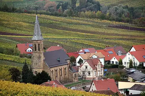
Birkweiler is a municipality in the Südliche Weinstraße district, in Rhineland-Palatinate, Germany.
Location
The municipality is a typical wine village on the German Wine Route in the Siebelding valley at the foot of the Hohenberg (556 m with an observation tower).
References
- ^ Direktwahlen 2019, Landkreis Südliche Weinstraße, Landeswahlleiter Rheinland-Pfalz, accessed 10 August 2021.
- ^ Bevölkerungsstand 31. Dezember 2023, Landkreise, Gemeinden, Verbandsgemeinden; Fortschreibung des Zensus 2011 (in German), Statistisches Landesamt Rheinland-Pfalz, 2024