Blackfoot, Montana
Blackfoot, Montana | |
|---|---|
| Coordinates: 48°34′38″N 112°52′30″W / 48.57722°N 112.87500°W | |
| Country | United States |
| State | Montana |
| County | Glacier |
| Area | |
• Total | 0.34 sq mi (0.88 km2) |
| • Land | 0.34 sq mi (0.88 km2) |
| • Water | 0.00 sq mi (0.00 km2) |
| Elevation | 4,154 ft (1,266 m) |
| Population (2020) | |
• Total | 109 |
| • Density | 321.53/sq mi (124.30/km2) |
| FIPS code | 30-07300 |
| GNIS feature ID | 2806620[2] |
Blackfoot is a census-designated place along the Flatiron[3] and Willow[4] creeks on the Blackfeet Nation in Glacier County, Montana, United States, about 26 miles (42 km) west of Cut Bank.
U.S. Route 2 passes by the southeast edge of the community.[5]
Demographics
| Census | Pop. | Note | %± |
|---|---|---|---|
| 2020 | 109 | — | |
| U.S. Decennial Census[6] | |||
See also
References
- ^ "ArcGIS REST Services Directory". United States Census Bureau. Retrieved September 18, 2022.
- ^ a b U.S. Geological Survey Geographic Names Information System: Blackfoot, Montana
- ^ U.S. Geological Survey Geographic Names Information System: Flatiron Creek
- ^ U.S. Geological Survey Geographic Names Information System: Willow Creek
- ^ "Blackfoot, Montana 59427" (Map). Google Maps. Retrieved December 20, 2020.
- ^ "Census of Population and Housing". Census.gov. Retrieved June 4, 2016.
Municipalities and communities of Glacier County, Montana, United States | ||
|---|---|---|
| City | 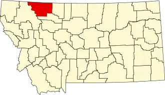 | |
| Town | ||
| CDPs | ||
| Indian reservation | ||
| Footnotes | ‡This populated place also has portions in an adjacent county or counties | |