Blokland, Utrecht
Blokland | |
|---|---|
Hamlet | |
 The Bloklandse Dijk | |
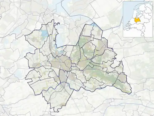 Blokland Location in the Netherlands  Blokland Blokland (Netherlands) | |
| Coordinates: 52°1′47″N 4°57′37″E / 52.02972°N 4.96028°E | |
| Country | Netherlands |
| Province | Utrecht |
| Municipality | Montfoort |
| Area | |
• Total | 0.73 km2 (0.28 sq mi) |
| Population (2021)[1] | |
• Total | 140 |
| • Density | 190/km2 (500/sq mi) |
| Time zone | UTC+1 (CET) |
| • Summer (DST) | UTC+2 (CEST) |
| Postal code | 3417[1] |
| Dialing code | 0348 |
Blokland is a hamlet in the Dutch province of Utrecht. It is a part of the municipality of Montfoort, and lies about 1 km southeast of that city, and 6 km west of IJsselstein.[2] Blokland has a population of around 160.[3]
Blokland was a heerlijkheid (manor), covering the entire polder "Blokland", which is the area south of the Bloklandse Dijk.[4]
When the current municipal system was introduced in the Netherlands in 1812, Blokland became part of the municipality Montfoort for a short while. It was part of the municipality of Willeskop between 1818 and 1989, when that municipality was merged with Montfoort.[5]
The hamlet was first mentioned in 1261 as Blokelant, and means enclosed land.[6] The postal authorities have placed it under Montfoort.[7] Blokland has no place name signs. In 1840, it was home to 142 people.[5]
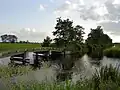
Gallery
-
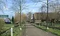 Street view
 -
Landscape
References
- ^ a b c "Kerncijfers wijken en buurten 2021". Central Bureau of Statistics. Retrieved 28 March 2022.
- ^ ANWB Topografische Atlas Nederland, Topografische Dienst and ANWB, 2005.
- ^ Statistics Netherlands, 2007. Figures are for the year 2006. Statistics are available in Google Earth format. Statistical area "Blokland".
- ^ Abraham Jacob van der Aa, "Aardrijkskundig woordenboek der Nederlanden", vol. 1 (A), 1839.
- ^ a b "Blokland (Montfoort)". Plaatsengids (in Dutch). Retrieved 28 March 2022.
- ^ "Blokland - (geografische naam)". Etymologiebank (in Dutch). Retrieved 28 March 2022.
- ^ "Postcode 3417 in Montfoort". Postcode bij adres (in Dutch). Retrieved 28 March 2022.