Brightgate
| Brightgate | |
|---|---|
 Brightgate Location within Derbyshire | |
| OS grid reference | SK264596 |
| Shire county | |
| Region | |
| Country | England |
| Sovereign state | United Kingdom |
| Post town | Matlock |
| Postcode district | DE4 |
| Police | Derbyshire |
| Fire | Derbyshire |
| Ambulance | East Midlands |
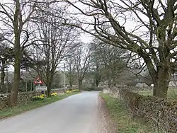
Brightgate is a village in Derbyshire, England.[1][2] The population is recorded in the civil parish of Bonsall, Derbyshire.
References
- ^ Ordnance Survey: Landranger map sheet 119 Buxton & Matlock (Chesterfield, Bakewell & Dove Dale) (Map). Ordnance Survey. 2012. ISBN 9780319231890.
- ^ "Ordnance Survey: 1:50,000 Scale Gazetteer" (csv (download)). www.ordnancesurvey.co.uk. Ordnance Survey. 1 January 2016. Retrieved 30 January 2016.
Wikimedia Commons has media related to Brightgate, Derbyshire.