Buckshutem, New Jersey
Buckshutem, New Jersey | |
|---|---|
 Buckshutem Location in Cumberland County (Inset: Cumberland County in New Jersey)  Buckshutem Buckshutem (New Jersey)  Buckshutem Buckshutem (the United States) | |
| Coordinates: 39°19′08″N 75°00′46″W / 39.31889°N 75.01278°W | |
| Country | |
| State | |
| County | Cumberland |
| Township | Commercial |
| Elevation | 6 m (20 ft) |
| Time zone | UTC−05:00 (Eastern (EST)) |
| • Summer (DST) | UTC−04:00 (Eastern (EDT)) |
| Area code | 856 |
| GNIS feature ID | 875011[1] |
Buckshutem is an unincorporated community located within Commercial Township, in Cumberland County, in the U.S. state of New Jersey.[2][3][4] The community is situated near Buckshutem Creek, nearby Laurel Lake. The name "Buckshutem" is of Native American origin; though others say that the name is derived from the creek's rapid flow of water as it empties into the brisk wake of the Maurice River, producing a cross current that causes a boat to "buck and shoot" through that section.[5]
References
- ^ U.S. Geological Survey Geographic Names Information System: Buckshutem, New Jersey
- ^ Beck, Henry Charlton (1963). More Forgotten Towns of Southern New Jersey. Rutgers University Press. ISBN 9780813504322.
{{cite book}}: ISBN / Date incompatibility (help) - ^ Locality Search, State of New Jersey. Accessed June 9, 2016.
- ^ Gannett, Henry (January 28, 1895). "A Geographic Dictionary of New Jersey". U.S. Government Printing Office – via Google Books.
- ^ Debra A. Barsotti. "Maurice River Recollections Project". Citizens United. Retrieved July 8, 2012.
Municipalities and communities of Cumberland County, New Jersey, United States | ||
|---|---|---|
| Cities | 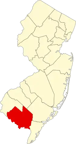 | |
| Borough | ||
| Townships | ||
| CDPs |
| |
| Other communities | ||
| Footnotes | ‡This populated place also has portions in an adjacent county or counties | |