Bulukumba Regency
Bulukumba Regency
Kabupaten Bulukumba | |
|---|---|
| Other transcription(s) | |
| • Buginese | ᨀᨅᨘᨄᨈᨛ ᨅᨘᨒᨘᨀᨘᨅ |
 Coat of arms | |
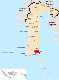 Location within South Sulawesi | |
| Country | Indonesia |
| Province | South Sulawesi |
| Capital | Ujung Bulu |
| Government | |
| • Regent | Andi Muchtar Ali Yusuf |
| • Vice Regent | Andi Edy Manaf |
| Area | |
• Total | 1,175.53 km2 (453.87 sq mi) |
| Population (mid 2023 estimate)[1] | |
• Total | 471,688 |
| • Density | 400/km2 (1,000/sq mi) |
| Time zone | UTC+8 (WITA) |
| Area code | +62 413 |
| Website | www.bulukumbakab.go.id |
Bulukumba Regency is a regency in the southeast corner of South Sulawesi Province, Indonesia.[2] It covers an area of 1,175.53 km2, and had a population of 394,757 at the 2010 Census[3] and 437,607 at the 2020 Census;[4] the official estimate for mid 2022 was 471,688 (including 230,557 males and 241,131 females).[1] The town of Ujung Bulu is its capital.
Administrative Districts
Bulukumba Regency is divided into ten Districts (Kecamatan), tabulated below with their areas and their populations at the 2010 Census[3] and 2020 Census,[4] together with the official estimates for mid 2023.[1] The table also includes the locations of the district administrative centres, the number of villages in each district (totaling 109 rural desa and 27 urban kelurahan), and its postal code.

| Kode Wilayah |
Name in District (kecamatan) |
Area in km2 |
Pop'n Census 2010 |
Pop'n Census 2020 |
Pop'n Estimate mid 2023 |
Admin centre |
No. of villages |
Post code |
|---|---|---|---|---|---|---|---|---|
| 73.02.01 | Gantarang | 175.84 | 71,307 | 81,173 | 88,151 | Ponre | 21 (a) | 92561 |
| 73.02.02 | Ujung Bulu (town) | 14.63 | 47,886 | 49,060 | 51,393 | Terang-Terang | 9 (b) | 92511 (c) |
| 73.02.09 | Ujung Loe | 146.25 | 39,233 | 46,750 | 50,825 | Dannuang | 13 (d) | 92562 |
| 73.02.03 | Bonto Bahari | 115.51 | 24,116 | 28,255 | 30,495 | Tanah Lemo | 8 (e) | 92571 |
| 73.02.04 | Bontotiro | 79.39 | 22,768 | 26,920 | 29,389 | Ekatiro | 13 (d) | 92572 |
| 73.02.05 | Hero Lange-Lange (or 'Herlang') |
69.71 | 24,041 | 27,931 | 30,422 | Tanuntung | 8 (f) | 92573 |
| 73.02.06 | Kajang | 130.79 | 46,983 | 48,628 | 53,193 | Kassi | 19 (g) | 92574 |
| 73.02.07 | Bulukumpa | 173.63 | 50,607 | 54,087 | 56,741 | Tanete | 17 (h) | 92552 |
| 73.02.10 | Rilau Ale | 119.11 | 37,871 | 42,188 | 45,872 | Palampang | 15 (d) | 92553 |
| 73.02.08 | Kindang | 150.67 | 29,748 | 32,615 | 35,207 | Borong Rapooa | 13 (d) | 92517 |
| Totals | 1,175,53 | 394,757 | 437,607 | 471,688 | Ujung Bulu | 136 |
Note: (a) including 3 kelurahan - Jalanjang, Mario Rennu and Matekko. (b) all 9 are kelurahan - Bentengnge, Bintarore, Caile, Ela-Ela, Kalumeme, Kasimpureng, Loka, Tanah Kongkong and Terang-Terang.
(c) except for the kelurahan of Tanah Kongkong (whose postcode is 92513), Bintarore (92514), Caile (92517) and Kalumeme (92518).
(d) including one kelurahan - the district admin centre as named. (e) including 4 kelurahan - Benjala, Sapo Lohe, Tanah Beru and Tanah Lemo. (f) including 2 kelurahan - Bonto Kamase and Tanuntung.
(g) including 2 kelurahan - Laikang and Tanah Jaya. (h) including 3 kelurahan - Balla Saraja, Jawijawi and Tanete.
Pinisi ships
The traditional wooden Pinisi ships are built in Bulukumba, e.g. in Lemo-lemo village.[5]
Climate
Bulukumba has a tropical monsoon climate (Am) with moderate to little rainfall from August to November and heavy rainfall from December to July. The following climate data is for the town of Bulukumba.
| Climate data for Bulukumba | |||||||||||||
|---|---|---|---|---|---|---|---|---|---|---|---|---|---|
| Month | Jan | Feb | Mar | Apr | May | Jun | Jul | Aug | Sep | Oct | Nov | Dec | Year |
| Mean daily maximum °C (°F) | 30.0 (86.0) |
30.0 (86.0) |
30.4 (86.7) |
31.0 (87.8) |
31.2 (88.2) |
30.8 (87.4) |
30.9 (87.6) |
31.5 (88.7) |
32.0 (89.6) |
32.3 (90.1) |
31.5 (88.7) |
30.3 (86.5) |
31.0 (87.8) |
| Daily mean °C (°F) | 26.4 (79.5) |
26.5 (79.7) |
26.6 (79.9) |
26.8 (80.2) |
26.9 (80.4) |
26.2 (79.2) |
25.8 (78.4) |
25.9 (78.6) |
26.5 (79.7) |
27.1 (80.8) |
27.2 (81.0) |
26.6 (79.9) |
26.5 (79.8) |
| Mean daily minimum °C (°F) | 22.8 (73.0) |
23.0 (73.4) |
22.8 (73.0) |
22.7 (72.9) |
22.6 (72.7) |
21.7 (71.1) |
20.7 (69.3) |
20.4 (68.7) |
21.0 (69.8) |
21.9 (71.4) |
22.9 (73.2) |
22.9 (73.2) |
22.1 (71.8) |
| Average rainfall mm (inches) | 166 (6.5) |
138 (5.4) |
152 (6.0) |
198 (7.8) |
305 (12.0) |
271 (10.7) |
153 (6.0) |
59 (2.3) |
32 (1.3) |
61 (2.4) |
92 (3.6) |
148 (5.8) |
1,775 (69.8) |
| Source: Climate-Data.org[6] | |||||||||||||
Tourism
Bulukumba has many beach tourist destinations such as [7]
- Tanjung Bira Beach
- Apparalang Beach
- Panrang Luhu Beach
- Marumasa Beach
- Kasuso Beach
- Mandala Ria Beach
- Bara Beach
- Liukang Loe Island Beach
- Lemo-lemo Beach
- Samboang Beach
- Kambing Island Beach
- Ujung Tiro Beach
- Kaluku Beach
- Pusahelu Beach
References
- ^ a b c Badan Pusat Statistik, Jakarta, 28 February 2024, Kabupaten Bulukumba Dalam Angka 2024 (Katalog-BPS 1102001.7302)
- ^ Maplandia.com, retrieved 28 August 2009.
- ^ a b Biro Pusat Statistik, Jakarta, 2011.
- ^ a b Badan Pusat Statistik, Jakarta, 2021.
- ^ "Perahu Pinisi di Tanah Beru Bulukumba". June 24, 2013. Archived from the original on July 17, 2013.
- ^ "Climate: Bulukumba". Climate-Data.org. Retrieved 18 November 2020.
- ^ Alsair, Ach. Hidayat (2022). "=15 Destinasi Wisata Pantai di Bulukumba, Gak Jauh dari Tanjung Bira" [15 Beach Tourism Destinations in Bulukumba, Not Far from Tanjung Bira]. sulsel.idntimes.com (in Indonesian). Retrieved 11 July 2024.
Regencies and cities of South Sulawesi | ||
|---|---|---|
Capital: Makassar | ||
| Regencies |  | |
| Cities | ||
5°33′S 120°11′E / 5.550°S 120.183°E