Burggraf (fortification)
| Burggraf | |
|---|---|
Burggrafenstein, Furchste | |
| Gräfenberg-Thuisbrunn-"Burggraf" | |
 The Burggraf | |
| Site information | |
| Type | hill castle, spur castle |
| Code | DE-BY |
| Condition | burgstall (no above-ground ruins) |
| Location | |
 | |
| Coordinates | 49°40′54″N 11°16′56″E / 49.68171°N 11.28231°E |
| Height | Height missing, see template documentation |
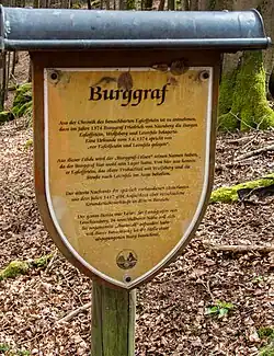
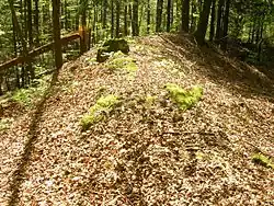
The fortification of Burggraf (German: Abschnittsbefestigung Burggraf), also called the Burggrafenstein or Furchste, is a levelled prehistorical or early medieval sector fortification on a hill spur between Untertrubach and Dörnhof near Gräfenberg in the county of Forchheim in the south German state of Bavaria.
The fortification was recorded in 1417 as a burgstall. It consisted of ramparts and an entrance passage at the southwest corner and probably a second on the southeast side. Only the remains of two sector ramparts have survived.
Literature
- Walter Heinz: Ehemalige Adelssitze im Trubachtal. Verlag Palm und Enke, Erlangen und Jena, 1996, ISBN 3-7896-0554-9
External links
Wikimedia Commons has media related to Abschnittsbefestigung Burggraf.
- "Burggraf". Alle Burgen (in German).
Castles in the county of Forchheim | |||
|---|---|---|---|
 | Schlösser: |
| 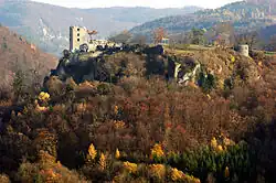 |
| Castles and castle ruins: |
| ||
| Fortresses: | |||
| Motte castles: (all levelled) | |||
| Manor houses: |
| ||
| Burgställe: (castle/hillfort sites) |
| ||