Bystry Tanyp
| Bystry Tanyp | |
|---|---|
 | |
| Native name | Быстрый Танып (Russian) |
| Location | |
| Country | Russia |
| Physical characteristics | |
| Mouth | Belaya |
• coordinates | 55°42′18″N 54°33′26″E / 55.70500°N 54.55722°E |
| Length | 345 km (214 mi) |
| Basin size | 7,560 km2 (2,920 sq mi) |
| Basin features | |
| Progression | Belaya→ Kama→ Volga→ Caspian Sea |
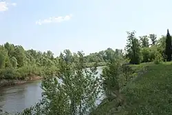
The Bystry Tanyp or Tanyp (Bashkir: Тере Танып, Етеҙ Танып, Tere Tanıp, Eteź Tanıp; Russian: Быстрый Танып), is a river in Bashkortostan and Perm Krai in Russia, a right tributary of the Belaya.[1] The river is 345 kilometres (214 mi) long, and the area of its drainage basin is 7,560 square kilometres (2,920 sq mi).[2] The Bystry Tanyp freezes up in the first half of November and remains icebound until April.
References
- ^ Танып, Great Soviet Encyclopedia
- ^ «Река Б.ТАНЫП», Russian State Water Registry