Calabozo Airport
Calabozo Airport Aeropuerto de Calabozo | |||||||||||
|---|---|---|---|---|---|---|---|---|---|---|---|
 | |||||||||||
| Summary | |||||||||||
| Airport type | Public | ||||||||||
| Operator | Government | ||||||||||
| Serves | Calabozo, Venezuela | ||||||||||
| Elevation AMSL | 328 ft / 100 m | ||||||||||
| Coordinates | 8°55′30″N 67°25′00″W / 8.92500°N 67.41667°W | ||||||||||
| Map | |||||||||||
.svg.png) CLZ Location of the airport in Venezuela | |||||||||||
| Runways | |||||||||||
| |||||||||||
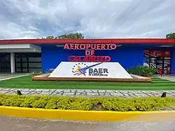
Calabozo Airport (Spanish: Aeropuerto de Calabozo) (IATA: CLZ, ICAO: SVCL) is an airport serving Calabozo, a town in Guárico state in Venezuela.
The Calabozo non-directional beacon (Ident: CZO) is located on the field.[4]
See also
References
- ^ "Airport information for SVCL". World Aero Data. Archived from the original on 2019-03-05. Data current as of October 2006.
- ^ Airport information for CLZ at Great Circle Mapper.
- ^ Google Maps - Calabozo
- ^ CZO NDB
External links
- OurAirports - Calabozo
- OpenStreetMap - Calabozo
- SkyVector - Calabozo Airport
- Accident history for CLZ at Aviation Safety Network