Image
[ 1] Landmark name
Location
City or town
Summary
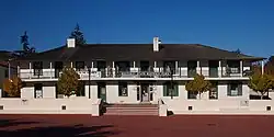
Asilomar State Beach and Conference Grounds 1052
Asilomar State Beach and Conference Grounds
800 Asilomar Ave. 36°37′08″N 121°56′18″W / 36.618775°N 121.938208333333°W / 36.618775; -121.938208333333 (Asilomar State Beach and Conference Grounds ) Pacific Grove Registered February 7, 2014 and dedicated on the 150th anniversary of the California State Parks
California's First Theater 136
California's First Theater
Pacific & Scott Sts. 36°36′11″N 121°53′44″W / 36.602943°N 121.895552°W / 36.602943; -121.895552 (California's First Theater ) Monterey Part of Monterey State Historic Park
Casa de Oro 532
Casa de Oro
210 Olivier St. 36°36′10″N 121°53′41″W / 36.602874°N 121.89463°W / 36.602874; -121.89463 (Casa de Oro ) Monterey Part of Monterey State Historic Park
Casa Materna of the Vallejos 387
Casa Materna of the Vallejos
Hillcrest Rd. & Salinas Rd. 36°52′35″N 121°45′43″W / 36.876486°N 121.762016°W / 36.876486; -121.762016 (Casa Materna of the Vallejos ) Las Lomas
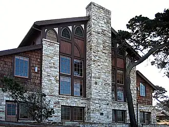
Chautauqua Hall 839
Chautauqua Hall
16th St. & Central Ave. 36°37′20″N 121°55′06″W / 36.62212°N 121.91826°W / 36.62212; -121.91826 (Chautauqua Hall ) Pacific Grove On July 20, 1970, the State Department of Parks and Recreation & City of Pacific Grove erected a landmark marker Number 839 at the Chautauqua Hall in Pacific Grove.
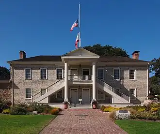
Colton Hall 126
Colton Hall
570 Pacific St. 36°35′52″N 121°53′51″W / 36.597764°N 121.897512°W / 36.597764; -121.897512 (Colton Hall ) Monterey
Custom House 1
Custom House
Custom House Plaza 36°36′12″N 121°53′37″W / 36.60325°N 121.893556°W / 36.60325; -121.893556 (Custom House ) Monterey Part of Monterey State Historic Park
Governor Alvarado House 348
Governor Alvarado House
494–498 Alvarado St. 36°35′52″N 121°53′43″W / 36.597852°N 121.895215°W / 36.597852; -121.895215 (Governor Alvarado House ) Monterey
Gutiérrez Adobe 713
Gutiérrez Adobe
590 Calle Principal 36°35′49″N 121°53′48″W / 36.596912°N 121.896789°W / 36.596912; -121.896789 (Gutiérrez Adobe ) Monterey Part of Monterey State Historic Park
Hill Town Ferry 560
Hill Town Ferry
Spreckels Blvd. & Old Hwy 68 36°37′47″N 121°40′43″W / 36.629795°N 121.678562°W / 36.629795; -121.678562 (Hill Town Ferry ) Old Hilltown
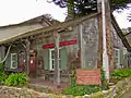
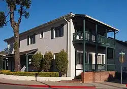
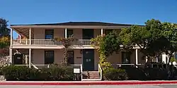
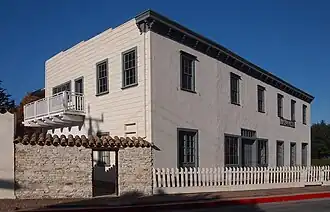
House of the Four Winds 353
House of the Four Winds
540 Calle Principal 36°35′51″N 121°53′47″W / 36.597617°N 121.896347°W / 36.597617; -121.896347 (House of the Four Winds ) Monterey Thomas Oliver Larkin built the House of Four Winds, named for the weather vane on its hipped roof. The building was used as an early State of California hall of records.
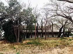
Jose Eusebio Boronda Adobe 870
Jose Eusebio Boronda Adobe
333 Boronda Rd. 36°42′03″N 121°40′44″W / 36.700944°N 121.678825°W / 36.700944; -121.678825 (Jose Eusebio Boronda Adobe ) Salinas
Landing Place of Vizcaino and Serra 128
Landing Place of Vizcaino and Serra
SW corner of Artillery and Pacific Sts. 36°36′17″N 121°53′43″W / 36.604702°N 121.895255°W / 36.604702; -121.895255 (Landing Place of Vizcaino and Serra ) Monterey
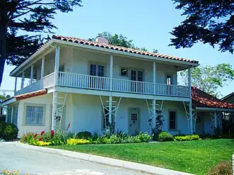
Larkin House 106
Larkin House
Calle Principal & Jefferson St. 36°35′53″N 121°53′46″W / 36.598104°N 121.896162°W / 36.598104; -121.896162 (Larkin House ) Monterey Part of Monterey State Historic Park
Mission Nuestra Señora de la Soledad 233
Mission Nuestra Señora de la Soledad
Fort Romie Rd. 36°24′17″N 121°21′21″W / 36.404778°N 121.355831°W / 36.404778; -121.355831 (Mission Nuestra Señora de la Soledad ) Soledad
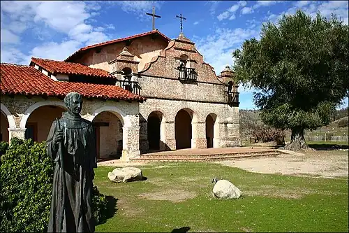
Mission San Antonio de Padua 232
Mission San Antonio de Padua
36°00′55″N 121°15′01″W / 36.015414°N 121.250314°W / 36.015414; -121.250314 (Mission San Antonio de Padua ) Jolon
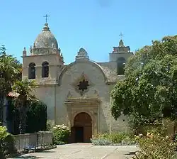
Mission San Carlos Borromeo de Carmelo 135
Mission San Carlos Borromeo de Carmelo
Lasuen Dr. and Rio Rd. 36°32′34″N 121°55′13″W / 36.542883°N 121.920155°W / 36.542883; -121.920155 (Mission San Carlos Borromeo de Carmelo ) Carmel
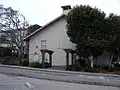
Old Pacific House 354
Old Pacific House
Custom House Plaza 36°36′09″N 121°53′39″W / 36.602612°N 121.894054°W / 36.602612; -121.894054 (Old Pacific House ) Monterey Part of Monterey State Historic Park
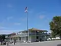
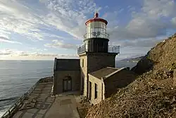
Point Sur Lighthouse 951
Point Sur Lighthouse
Point Sur State Historic Park 36°18′23″N 121°54′06″W / 36.306329°N 121.901656°W / 36.306329; -121.901656 (Point Sur Lighthouse ) Big Sur
Richardson Adobe 494
Richardson Adobe
Los Coches Rancho Wayside Campground 36°24′15″N 121°19′04″W / 36.404111°N 121.317904°W / 36.404111; -121.317904 (Richardson Adobe ) Soledad At Los Coches Rancho NRHP #79000502
Robert Louis Stevenson House 352
Robert Louis Stevenson House
530 Houston St. 36°35′50″N 121°53′36″W / 36.597319°N 121.893394°W / 36.597319; -121.893394 (Robert Louis Stevenson House ) Monterey Part of Monterey State Historic Park
Royal Presidio Chapel 105
Royal Presidio Chapel
550 Church St. 36°35′44″N 121°53′25″W / 36.595556°N 121.890411°W / 36.595556; -121.890411 (Royal Presidio Chapel ) Monterey
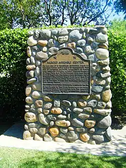
Salinas Assembly Center 934
Salinas Assembly Center
940 N. Main St. 36°41′28″N 121°38′56″W / 36.6912°N 121.649017°W / 36.6912; -121.649017 (Salinas Assembly Center ) Salinas
Site of the Battle of Natividad 651
Site of the Battle of Natividad
San Juan Grade & Crazy Horse Canyon Rd. 36°46′23″N 121°36′13″W / 36.772984°N 121.603605°W / 36.772984; -121.603605 (Site of the Battle of Natividad ) Prunedale
Soberanes Adobe 712
Soberanes Adobe
336 Pacific St. 36°36′05″N 121°53′45″W / 36.601417°N 121.895829°W / 36.601417; -121.895829 (Soberanes Adobe ) Monterey Part of Monterey State Historic Park
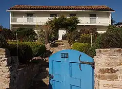
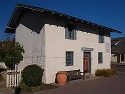
Vásquez House 351
Vásquez House
546 Dutra St. 36°35′52″N 121°53′53″W / 36.597876°N 121.897986°W / 36.597876; -121.897986 (Vásquez House ) Monterey


.jpg)