Image
[ 1] Landmark name
Location
Neighborhood/Region
Summary
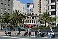
Birthplace of the United Nations, War Memorial Complex 964
Birthplace of the United Nations, War Memorial Complex
San Francisco War Memorial and Performing Arts Center 37°46′46″N 122°25′14″W / 37.7795833333333°N 122.420480555556°W / 37.7795833333333; -122.420480555556 (Birthplace of the United Nations, War Memorial Complex ) Civic Center
California Masonic Lodge No. 1 408
California Masonic Lodge No. 1
728 Montgomery St. 37°47′45″N 122°24′12″W / 37.795911°N 122.403347°W / 37.795911; -122.403347 (California Masonic Lodge No. 1 ) Jackson Square
California Theatre 86
California Theatre
430 Bush St., between Kearny St. and Grant Ave. 37°47′27″N 122°24′17″W / 37.790752°N 122.404668°W / 37.790752; -122.404668 (California Theatre ) Financial District
Castillo de San Joaquín 82
Castillo de San Joaquín
SE corner of fort wall, Fort Point (below Golden Gate Bridge) 37°48′38″N 122°28′36″W / 37.810417°N 122.476583°W / 37.810417; -122.476583 (Castillo de San Joaquín ) Presidio
City of Paris building 876
City of Paris building
SE corner of Geary and Stockton sts. 37°47′15″N 122°24′24″W / 37.787542°N 122.406547°W / 37.787542; -122.406547 (City of Paris building ) Union Square
Conservatory of Flowers 841
Conservatory of Flowers
100 John F. Kennedy Dr. 37°46′20″N 122°27′36″W / 37.7722894836207°N 122.46010392135669°W / 37.7722894836207; -122.46010392135669 (Conservatory of Flowers ) Golden Gate Park
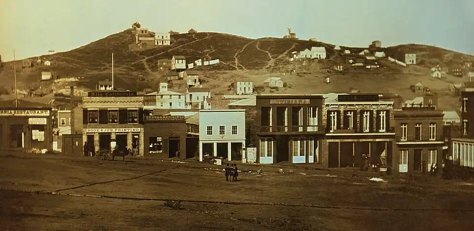
Eastern Terminus of Clay Street Hill Railroad 500
Eastern Terminus of Clay Street Hill Railroad
Portsmouth Square 37°47′41″N 122°24′18″W / 37.794692°N 122.405097°W / 37.794692; -122.405097 (Eastern Terminus of Clay Street Hill Railroad ) Chinatown
El Camino Real 784
El Camino Real
310-336 Dolores St. 37°45′51″N 122°25′35″W / 37.764106°N 122.426436°W / 37.764106; -122.426436 (El Camino Real ) Mission District The same plaque is located in San Diego
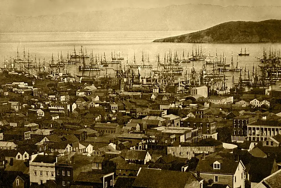
Entrance of the San Carlos into San Francisco Bay 236
Entrance of the San Carlos into San Francisco Bay
Aquatic Park , NW corner of Beach and Larkin sts.37°48′24″N 122°25′22″W / 37.806742°N 122.422709°W / 37.806742; -122.422709 (Entrance of the San Carlos into San Francisco Bay ) Fisherman's Wharf
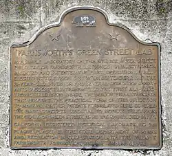
Farnsworth's Green Street Lab 941
Farnsworth's Green Street Lab
NW corner of Sansome and Green sts. 37°48′01″N 122°24′10″W / 37.80037269550264°N 122.40274303312091°W / 37.80037269550264; -122.40274303312091 (Farnsworth's Green Street Lab ) North Beach
Upload Photo
1002
First dynamite factory in the United States
Glen Canyon Park 37°44′20″N 122°26′31″W / 37.739°N 122.442°W / 37.739; -122.442 (First dynamite factory in the United States ) Diamond Heights /Glen Park The location of a subsequent Giant Powder Company factory in Point Pinole is listed as California Historical Landmark number 1002-1 .
First Jewish religious services in San Francisco 462
First Jewish religious services in San Francisco
735 Montgomery St., between Washington and Jackson sts. 37°47′46″N 122°24′13″W / 37.796133°N 122.403517°W / 37.796133; -122.403517 (First Jewish religious services in San Francisco ) Jackson Square
First public school in California 587
First public school in California
Portsmouth Plaza 37°47′41″N 122°24′20″W / 37.7946°N 122.40545°W / 37.7946; -122.40545 (First public school in California ) Chinatown
First San Francisco Mint building 87
First San Francisco Mint building
608-610 Commercial St. 37°47′39″N 122°24′12″W / 37.794217°N 122.403217°W / 37.794217; -122.403217 (First San Francisco Mint building ) Financial District
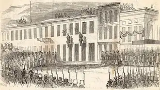
Fort Gunnybags 90
Fort Gunnybags
S side of Sacramento St. between Davis and Front sts. 37°47′40″N 122°23′54″W / 37.794328°N 122.398417°W / 37.794328; -122.398417 (Fort Gunnybags ) Financial District
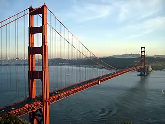
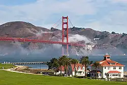
Golden Gate Bridge 974
Golden Gate Bridge
Toll gate area, S end of bridge 37°48′26″N 122°28′32″W / 37.80718069881731°N 122.47566821409279°W / 37.80718069881731; -122.47566821409279 (Golden Gate Bridge ) Presidio
Hudson's Bay Company headquarters 819
Hudson's Bay Company headquarters
505 Montgomery St. 37°47′39″N 122°24′12″W / 37.794167°N 122.403333°W / 37.794167; -122.403333 (Hudson's Bay Company headquarters ) Financial District
Juana Briones, pioneer settler of Yerba Buena 1024
Juana Briones, pioneer settler of Yerba Buena
Washington Square 37°48′04″N 122°24′34″W / 37.801125°N 122.409522°W / 37.801125; -122.409522 (Juana Briones, pioneer settler of Yerba Buena ) North Beach
Landing place of Captain J. Montgomery 81
Landing place of Captain J. Montgomery
552 Montgomery St. 37°47′41″N 122°24′19″W / 37.7947°N 122.4053°W / 37.7947; -122.4053 (Landing place of Captain J. Montgomery ) Financial District
Laurel Hill Cemetery 760
Laurel Hill Cemetery
3333 California St. Laurel Heights
Liberty Bell Slot Machine 937
Liberty Bell Slot Machine
Traffic island on N side of Market St. between Bush and Battery sts. 37°47′28″N 122°23′58″W / 37.79105°N 122.39935°W / 37.79105; -122.39935 (Liberty Bell Slot Machine ) Financial District
Long Wharf 328
Long Wharf
Leidesdorff and Commercial sts. Financial District
Lucas, Turner & Co. Bank 453
Lucas, Turner & Co. Bank
NE corner of Jackson and Montgomery sts. Jackson Square
Mark Hopkins Institute of Art 754
Mark Hopkins Institute of Art
California and Mason sts. Nob Hill
Upload Photo
459
Mellus and Howard
555 Montgomery St. Financial District
Montgomery Block 80
Montgomery Block
600 Montgomery St. 37°47′42″N 122°24′11″W / 37.795047°N 122.403122°W / 37.795047; -122.403122 (Montgomery Block ) Financial District
Niantic Hotel 88
Niantic Hotel
First floor of Two Transamerica Center 37°47′42″N 122°24′08″W / 37.795083°N 122.402222°W / 37.795083; -122.402222 (Niantic Hotel ) Financial District
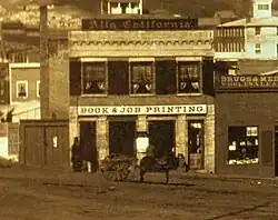
Office of the California Star newspaper 85
Office of the California Star newspaper
743 Washington St. Chinatown
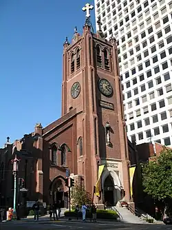
Old Saint Mary's Cathedral 810
Old Saint Mary's Cathedral
660 California St. 37°47′34″N 122°24′21″W / 37.79265°N 122.40575°W / 37.79265; -122.40575 (Old Saint Mary's Cathedral ) Nob Hill
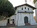
Original Mission Dolores and Dolores Lagoon 327
Original Mission Dolores and Dolores Lagoon
Camp and Albion sts. 37°45′51″N 122°25′22″W / 37.764033°N 122.422717°W / 37.764033; -122.422717 (Original Mission Dolores and Dolores Lagoon ) Mission District
Original site of the Bancroft Library 791
Original site of the Bancroft Library
1538 Valencia St. Mission District
Original site of St. Mary's College 772
Original site of St. Mary's College
Mission and College sts. Bernal Heights
Upload Photo
1010
Original site of the Third Baptist Church
Grant Ave. and Greenwich St. 37°48′09″N 122°24′28″W / 37.802417°N 122.407883°W / 37.802417; -122.407883 (Original site of the Third Baptist Church ) Telegraph Hill
Upload Photo
89
Parrott Granite Block
California and Montgomery sts. Financial District
Portsmouth Plaza 119
Portsmouth Plaza
Portsmouth Square Chinatown
Presidio of San Francisco 79
Presidio of San Francisco
Funston Ave. and Lincoln Blvd. 37°47′53″N 122°27′57″W / 37.798056°N 122.465833°W / 37.798056; -122.465833 (Presidio of San Francisco ) Presidio
Rincon Hill 84
Rincon Hill
Rincon and Bryant sts. Rincon Hill
San Francisco Mint 875
San Francisco Mint
88 5th St. at Mission St. 37°46′58″N 122°24′21″W / 37.782819°N 122.405847°W / 37.782819; -122.405847 (San Francisco Mint ) South of Market
Sarcophagus of Thomas Starr King 691
Sarcophagus of Thomas Starr King
First Unitarian Church (San Francisco) Western Addition
Site of the first California State Fair 861
Site of the first California State Fair
269 Bush St. 37°47′27″N 122°24′05″W / 37.790967°N 122.401333°W / 37.790967; -122.401333 (Site of the first California State Fair ) Financial District
Site of the Jenny Lind Theatre and San Francisco City Hall 192
Site of the Jenny Lind Theatre and San Francisco City Hall
750 Kearny St. at Merchant St. 37°47′42″N 122°24′17″W / 37.795058545420844°N 122.40480537291828°W / 37.795058545420844; -122.40480537291828 (Site of the Jenny Lind Theatre and San Francisco City Hall ) Portsmouth Square
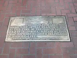
Tablets of San Francisco Bay 83
Tablets of San Francisco Bay
Plaques in sidewalk, NE and SW corners of Bush and Market sts. 37°47′29″N 122°23′57″W / 37.79125°N 122.399217°W / 37.79125; -122.399217 (Tablets of San Francisco Bay ) Financial District Tablets in downtown San Francisco marking the site of the original shoreline.
Telegraph Hill 91
Telegraph Hill
37°48′09″N 122°24′21″W / 37.802409°N 122.40587°W / 37.802409; -122.40587 (Telegraph Hill ) Telegraph Hill
Treasure Island 987
Treasure Island
37°49′N 122°22′W / 37.82°N 122.37°W / 37.82; -122.37 (Treasure Island ) Treasure Island
Union Square 623
Union Square
Geary and Powell sts. 37°47′17″N 122°24′27″W / 37.788056°N 122.4075°W / 37.788056; -122.4075 (Union Square ) Union Square
Western business headquarters of Russell, Majors and Waddell (Pony Express) 696
Western business headquarters of Russell, Majors and Waddell (Pony Express)
601 Montgomery St. 37°47′42″N 122°24′12″W / 37.794983°N 122.403333°W / 37.794983; -122.403333 (Western business headquarters of Russell, Majors and Waddell (Pony Express) ) Financial District
What Cheer House 650
What Cheer House
SW corner of Sacramento and Leidesdorff sts. 37°47′38″N 122°24′08″W / 37.793783°N 122.402167°W / 37.793783; -122.402167 (What Cheer House ) Financial District
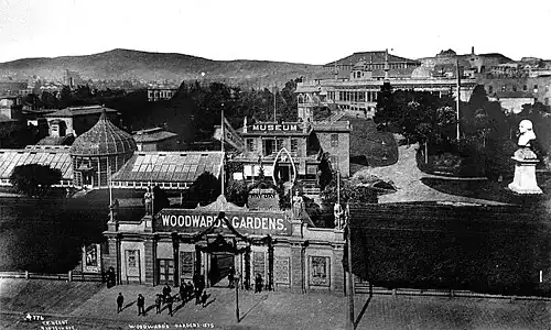
Woodward's Gardens 454
Woodward's Gardens
SW corner of Mission and Duboce sts. Mission District


.JPG)

_VIEW_OF_CLAY_STREET_SHOWING_THE_WIRE_RAILROAD_pg191.jpg)


.jpg)
.jpg)


.jpg)
.jpg)


.jpg)
_3.JPG)
.jpg)
.jpg)
.JPG)

.jpg)