Camboulit
Camboulit | |
|---|---|
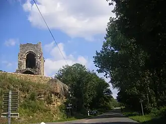 The ruins of the Chapelle St Martin in Camboulit | |
.svg.png) Coat of arms | |
Location of Camboulit | |
 Camboulit  Camboulit | |
| Coordinates: 44°36′03″N 1°57′02″E / 44.6008°N 1.9506°E | |
| Country | France |
| Region | Occitania |
| Department | Lot |
| Arrondissement | Figeac |
| Canton | Figeac-1 |
| Intercommunality | CC Grand-Figeac |
| Government | |
| • Mayor (2020–2026) | Jean-Claude Voynet[1] |
Area 1 | 5.19 km2 (2.00 sq mi) |
| Population (2022)[2] | 254 |
| • Density | 49/km2 (130/sq mi) |
| Time zone | UTC+01:00 (CET) |
| • Summer (DST) | UTC+02:00 (CEST) |
| INSEE/Postal code | 46052 /46100 |
| Elevation | 177–312 m (581–1,024 ft) (avg. 232 m or 761 ft) |
| 1 French Land Register data, which excludes lakes, ponds, glaciers > 1 km2 (0.386 sq mi or 247 acres) and river estuaries. | |
Camboulit (French pronunciation: [kɑ̃buli]; Occitan: Cambolit) is a commune in the Lot department in south-western France.
See also
References
- ^ "Répertoire national des élus: les maires" (in French). data.gouv.fr, Plateforme ouverte des données publiques françaises. 4 May 2022.
- ^ "Populations de référence 2022" (in French). The National Institute of Statistics and Economic Studies. 19 December 2024.
Wikimedia Commons has media related to Camboulit.