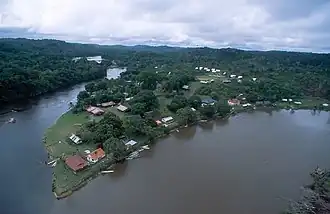
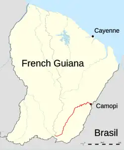
Camopi (river)
| Camopi | |
|---|---|
 | |
 | |
| Location | |
| Country | French Guiana |
| Physical characteristics | |
| Source | |
| • location | French Guiana |
| • coordinates | 2°20′26″N 53°18′40″W / 2.3406°N 53.311°W |
| Mouth | |
• location | Oyapock |
• coordinates | 3°10′15″N 52°19′53″W / 3.1707°N 52.3315°W |
| Length | 244 km (152 mi) |
| Basin features | |
| Progression | Oyapock→ Atlantic Ocean |
The Camopi (French pronunciation: [kamɔpi]) is a 244 kilometres (152 mi) long river in French Guiana.[1] It rises in the south of the country, flowing northeast until it reaches the river Oyapock at the town of Camopi, on the border with Brazil.
References