Candela, Apulia
Candela | |
|---|---|
| Comune di Candela | |
 | |
-Stemma.png) Coat of arms | |
Location of Candela | |
 Candela Location of Candela in Italy 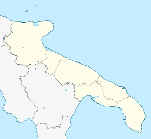 Candela Candela (Apulia) | |
| Coordinates: 41°8′N 15°31′E / 41.133°N 15.517°E | |
| Country | Italy |
| Region | Apulia |
| Province | Foggia (FG) |
| Government | |
| • Mayor | Nicola Gatta |
| Area | |
• Total | 96.82 km2 (37.38 sq mi) |
| Elevation | 474 m (1,555 ft) |
| Population (30 April 2017)[2] | |
• Total | 2,700 |
| • Density | 28/km2 (72/sq mi) |
| Demonym | Candelesi |
| Time zone | UTC+1 (CET) |
| • Summer (DST) | UTC+2 (CEST) |
| Postal code | 71024 |
| Dialing code | 0885 |
| Patron saint | Pope Clement I |
| Saint day | 7 |
| Website | Official website |
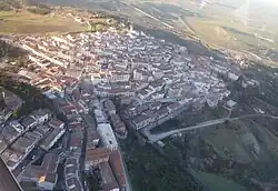
Candela (Pugliese: Cannéla) is a town and comune in the province of Foggia in the Apulia region of southeast Italy. It sits on 2 hills: San Rocco and San Tommaso.
References
- ^ "Superficie di Comuni Province e Regioni italiane al 9 ottobre 2011". Italian National Institute of Statistics. Retrieved 16 March 2019.
- ^ All demographics and other statistics from the Italian statistical institute (Istat).