Caorso
Caorso | |
|---|---|
| Comune di Caorso | |
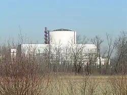 The old nuclear plant. | |
Location of Caorso | |
 Caorso Location of Caorso in Italy 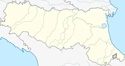 Caorso Caorso (Emilia-Romagna) | |
| Coordinates: 45°3′N 9°52′E / 45.050°N 9.867°E | |
| Country | Italy |
| Region | Emilia-Romagna |
| Province | Piacenza (PC) |
| Frazioni | Muradolo, Zerbio, Roncarolo, Fossadello |
| Government | |
| • Mayor | Roberta Battaglia |
| Area | |
• Total | 40.98 km2 (15.82 sq mi) |
| Elevation | 46 m (151 ft) |
| Population (30 April 2017)[2] | |
• Total | 4,718 |
| • Density | 120/km2 (300/sq mi) |
| Demonym | Caorsani |
| Time zone | UTC+1 (CET) |
| • Summer (DST) | UTC+2 (CEST) |
| Postal code | 29012 |
| Dialing code | 0523 |
| Website | Official website |
Caorso (Piacentino: Caurs) is a comune (municipality) in the Province of Piacenza in the Italian region Emilia-Romagna, located about 130 kilometres (81 mi) northwest of Bologna and about 13 kilometres (8 mi) east of Piacenza.
Caorso borders the following municipalities: Caselle Landi, Castelnuovo Bocca d'Adda, Cortemaggiore, Monticelli d'Ongina, Piacenza, Pontenure, San Pietro in Cerro.
Transportation
Caorso has a railway station on the Piacenza–Cremona line.
References
- ^ "Superficie di Comuni Province e Regioni italiane al 9 ottobre 2011". Italian National Institute of Statistics. Retrieved 16 March 2019.
- ^ All demographics and other statistics: Italian statistical institute Istat.
External links