Cappelle sul Tavo
Cappelle sul Tavo | |
|---|---|
| Comune di Cappelle sul Tavo | |
 | |
 Coat of arms | |
Location of Cappelle sul Tavo | |
 Cappelle sul Tavo Location of Cappelle sul Tavo in Italy 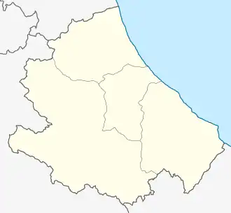 Cappelle sul Tavo Cappelle sul Tavo (Abruzzo) | |
| Coordinates: 42°28′N 14°06′E / 42.467°N 14.100°E | |
| Country | Italy |
| Region | Abruzzo |
| Province | Pescara (PE) |
| Frazioni | Staffieri |
| Government | |
| • Mayor | Lorenzo Ferri (since 2019)[1] (Ind.) |
| Area | |
• Total | 5.46 km2 (2.11 sq mi) |
| Elevation | 122 m (400 ft) |
| Population (2024)[3] | |
• Total | 4,068 |
| • Density | 750/km2 (1,900/sq mi) |
| Time zone | UTC+1 (CET) |
| • Summer (DST) | UTC+2 (CEST) |
| Postal code | 65010 |
| Dialing code | 085 |
| Patron saint | San Pasquale |
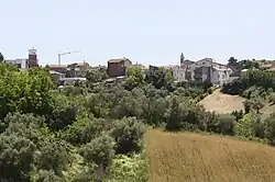
Cappelle sul Tavo (Abruzzese: Li Cappélle) is a comune and town in the Province of Pescara in the Abruzzo region of Italy.
History
Cappelle sul Tavo has been an independent municipality since 1905.[4] Previously, it was part of the municipality of Montesilvano.
The name probably derives from a number of small "cappelle" (chapels) among the woods. The name "Cappelle" also appears in documents of the 11th and 14th centuries[5] and is represented in the emblem of the town, showing two Gothic chapels.
- Images of Cappelle sul Tavo
-
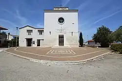 The Church Beata Vergine Maria Lauretana
 -
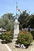 World War I memorial
 -
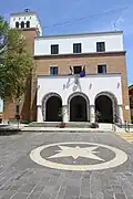 town hall
References
- ^ "Anagrafe degli Amministratori Locali e Regionali". amministratori.interno.gov.it. Retrieved 16 May 2024.
- ^ "Superficie di Comuni Province e Regioni italiane al 9 ottobre 2011". Italian National Institute of Statistics. Retrieved 16 March 2019.
- ^ "Bilancio demografico mensile". demo.istat.it. Retrieved 16 May 2024.
- ^ "La Storia". www.comune-cappellesultavo-pe.it. Retrieved 16 May 2024.
- ^ Dizionario Di Toponomastica: Storia E Significato Dei Nomi Geografici Italiani. Garzanti. 1990. p. 136. Retrieved 16 May 2024.