Carillon hydroelectric generating station
| Carillon generating station | |
|---|---|
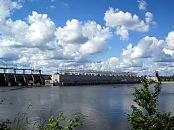 The Carillon generating station and dam | |
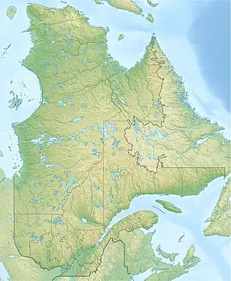 Location of Carillon generating station in Quebec | |
| Official name | Centrale de Carillon |
| Location | Saint-André-d'Argenteuil, Quebec / East Hawkesbury, Ontario Canada |
| Coordinates | 45°34′07″N 74°23′01″W / 45.56861°N 74.38361°W |
| Status | Operational |
| Construction began | 1959 |
| Opening date | 1962 |
| Owner(s) | Hydro-Québec |
| Dam and spillways | |
| Type of dam | Barrage |
| Impounds | Ottawa River |
| Reservoir | |
| Surface area | 26 km2 (10 sq mi) |
| Power Station | |
| Hydraulic head | 17.99 m (59.0 ft) |
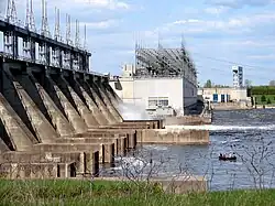
| Turbines | 14 × kaplan propeller-type turbines |
| Installed capacity | 752 MW |
The Carillon generating station (in French: centrale de Carillon) is a hydroelectric power station on the Ottawa River near Carillon, Quebec, Canada. Built between 1959 and 1964, it is managed and operated by Hydro-Québec. It is a run-of-river generating station with an installed capacity of 752 megawatts (1,008,000 hp), a head of 17.99 meters (59.0 ft), and a reservoir of 26 square kilometers (10 sq mi).[1] The dam spans the river between Carillon and Pointe-Fortune, Quebec.
Upon completion, the dam raised the water level by over 62 feet (19 m) at Carillon and over 9 feet (2.7 m) at Grenville. This inundated the rapids of Long-Sault on the Ottawa River, transforming them into calm (deeper) water. The dam also includes a modern lock that facilitates traffic on the Ottawa River, superseding the Carillon Canal.[2][3]
See also
References
- ^ "Hydro-Québec Carillon Generating Station". Archived from the original on 2006-03-14. Retrieved 2009-02-13.
- ^ "Canal" (in French). Village de Grenville. Retrieved 2009-02-09.
- ^ Lynch, Charles (2 November 1961). "Carillon power project going day and night". Ottawa Journal. Retrieved 27 January 2017.
External links
 Media related to Carillon Generating Station at Wikimedia Commons
- Hydro-Québec English Web page