Castle Mountains (Montana)
| Castle Mountains | |
|---|---|
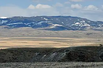 Western face of Castle Mountains near Ringling, Montana | |
| Highest point | |
| Peak | Elk Peak (Meagher County, Montana) |
| Elevation | 8,589 ft (2,618 m) |
| Coordinates | 46°28′11″N 110°45′54″W / 46.46972°N 110.76500°W |
| Geography | |
| Country | United States |
| State | Montana |
The Castle Mountains, highest point Elk Peak, el. 8,589 feet (2,618 m),[1] are an island range east of White Sulphur Springs in Meagher County, Montana, United States.[2] About 30,000 acres of the Castles were roadless as of 1995.[3] The western portion of the Castles are moist, while the eastside is dry, porous limestone hills.[3] The range gets its name from "castle turrets", 50-foot high igneous rock spires on the western slopes.[3] The range was the focus of mining activity in the previous century; crumbling remains of old miners' cabins and diggings are present throughout the area.[4] The landscape is characterized by a central cluster of peaks over 8,000 feet and extensive grassy parks surrounded by lodgepole pine and limber pine.[3] The Castles are lightly used by recreationists except for hunters in the fall.[3] On the peak of Castle Mountain itself is a logbook for the few who reach the top. There is no trail that leads to the peak.
-
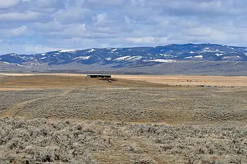 Southern face of Castle Mountains from Ringling, Montana
 -
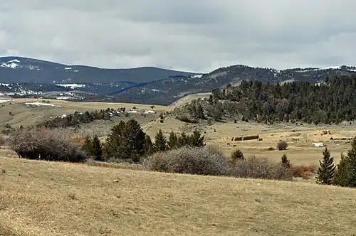 Southeastern corner of Castle Mountain on Castle Town road
See also
Notes
- ^ Recreational Map of Western Montana. Canon City, CO: Western GeoGraphics. 1990. ISBN 0-528-92551-2.
- ^ "Castle Mountains". Geographic Names Information System. United States Geological Survey, United States Department of the Interior.
- ^ a b c d e Cunningham, Bill (1995). Wild Montana. Helena, MT: Falcon Publishing, Inc. p. 237. ISBN 1-56044-393-6.
- ^ Cunningham (1995), pp. 240