Chapelle-lez-Herlaimont
Chapelle-lez-Herlaimont
El Tchapele (Walloon) | |
|---|---|
.JPG) | |
 Flag 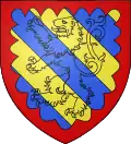 Coat of arms | |
Location of Chapelle-lez-Herlaimont | |
 Chapelle-lez-Herlaimont Location in Belgium
Location of Chapelle-lez-Herlaimont in Hainaut 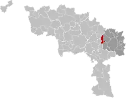 | |
| Coordinates: 50°28′N 04°17′E / 50.467°N 4.283°E | |
| Country | Belgium |
| Community | French Community |
| Region | |
| Province | |
| Arrondissement | Charleroi |
| Government | |
| • Mayor | Karl De Vos (PS) |
| • Governing party/ies | PS |
| Area | |
• Total | 18.21 km2 (7.03 sq mi) |
| Population (2018-01-01)[1] | |
• Total | 14,900 |
| • Density | 820/km2 (2,100/sq mi) |
| Postal codes | 7160 |
| NIS code | 52010 |
| Area codes | 064 |
| Website | www.chapelle-lez-herlaimont.be |
Chapelle-lez-Herlaimont (French pronunciation: [ʃapɛl le ɛʁlɛmɔ̃] ⓘ; Walloon: El Tchapele) is a municipality of Wallonia located in the province of Hainaut, Belgium.
On January 1, 2018, Chapelle-lez-Herlaimont had a total population of 14,900. The total area is 18.10 km² which gives a population density of 820 inhabitants per km².
The municipality consists of the following districts: Chapelle-lez-Herlaimont, Godarville, and Piéton.
Famous inhabitants
- Alphonse Briart, geologist
References
- ^ "Wettelijke Bevolking per gemeente op 1 januari 2018". Statbel. Retrieved 9 March 2019.
External links
 Media related to Chapelle-lez-Herlaimont at Wikimedia Commons
Places adjacent to Chapelle-lez-Herlaimont | ||||||||||||||||
|---|---|---|---|---|---|---|---|---|---|---|---|---|---|---|---|---|
| ||||||||||||||||
| Ath | 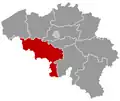 | |
|---|---|---|
| Charleroi | ||
| La Louvière | ||
| Mons | ||
| Soignies | ||
| Thuin | ||
| Tournai-Mouscron | ||
| ||