Cherrystone Creek
| Cherrystone Creek Tributary to Banister River | |
|---|---|
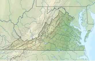 Location of Cherrystone Creek mouth  Cherrystone Creek (the United States) | |
| Location | |
| Country | United States |
| State | Virginia |
| County | Pittsylvania |
| City | Chatham |
| Physical characteristics | |
| Source | Potter Creek divide |
| • location | about 0.5 miles northeast of Redeye, Virginia |
| • coordinates | 36°55′01″N 079°27′56″W / 36.91694°N 79.46556°W[1] |
| • elevation | 970 ft (300 m)[2] |
| Mouth | |
• location | about 2 miles southwest of Motleys Mill, Virginia |
• coordinates | 36°48′26″N 079°20′23″W / 36.80722°N 79.33972°W[1] |
• elevation | 558 ft (170 m)[3] |
| Length | 13.36 mi (21.50 km)[4] |
| Basin size | 45.52 square miles (117.9 km2)[5] |
| Discharge | |
| • location | Banister River |
| • average | 57.03 cu ft/s (1.615 m3/s) at mouth with Banister River[5] |
| Basin features | |
| Progression | Banister River → Dan River → Roanoke River → Albemarle Sound → Pamlico Sound → Atlantic Ocean |
| River system | Roanoke River |
| Tributaries | |
| • left | Pole Bridge Branch Whites Branch Tanyard Branch Little Cherrystone Creek |
| • right | Roaring Fork Green Rock Branch |
| Waterbodies | Cherrystone Lake |
| Bridges | Old Red Eye Road, Anderson Mill Road, Hodnetts Mill Road, VA 57, US 29, Davis Road, Fairview Road |
Cherrystone Creek is a 13.36 mi (21.50 km) long 3rd order tributary to the Banister River in Pittsylvania County, Virginia. This is the only stream of this name in the United States.[1]
Course
Cherrystone Creek rises about 0.5 miles northeast of Redeye, Virginia, and then flows southeast and turns northeast to join the Banister River about 2 miles southwest of Motleys Mill.[3]
Watershed
Cherrystone Creek drains 45.52 square miles (117.9 km2) of area, receives about 45.7 in/year of precipitation, has a wetness index of 398.40, and is about 46% forested.[5]
See also
References
- ^ a b c "GNIS Detail - Cherrystone Creek". geonames.usgs.gov. US Geological Survey. Retrieved 11 August 2021.
- ^ "Get Maps". USGS Topoview. US Geological Survey. Retrieved 11 August 2021.
- ^ a b "Get Maps". USGS Topoview. US Geological Survey. Retrieved 11 August 2021.
- ^ "ArcGIS Web Application". epa.maps.arcgis.com. US EPA. Retrieved 11 August 2021.
- ^ a b c "Cherrystone Creek Watershed Report". US EPA Geoviewer. US EPA. Retrieved 11 August 2021.