Chevron, Kansas
Chevron, Kansas | |
|---|---|
 KDOT map of Scott County (legend) | |
 Chevron  Chevron | |
| Coordinates: 38°18′45″N 100°54′37″W / 38.31250°N 100.91028°W[1] | |
| Country | United States |
| State | Kansas |
| County | Scott |
| Elevation | 2,927 ft (892 m) |
| Time zone | UTC-6 (CST) |
| • Summer (DST) | UTC-5 (CDT) |
| Area code | 620 |
| FIPS code | 20-13010 |
| GNIS ID | 484923 [1] |
Chevron is an unincorporated community in Scott County, Kansas, United States.[1]
References
Further reading
Municipalities and communities of Scott County, Kansas, United States | ||
|---|---|---|
| Cities | 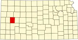 | |
| CDP | ||
| Unincorporated communities | ||
| Townships |
| |