Chharka Tangsong Rural Municipality
Chharka Tangsong
छार्का ताङसोङ गाउँपालिका | |
|---|---|
 Chharka Tangsong Location in Nepal | |
| Coordinates: 29°04′N 83°27′E / 29.07°N 83.45°E | |
| Country | |
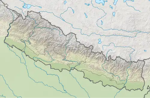
| Province | Karnali Province |
| District | Dolpa |
| Wards | 6 |
| Established | 10 March 2017 |
| Government | |
| • Type | Rural Council |
| • Chairperson | Mr. Shenang Gurung |
| • Vice-chairperson | Chhiring Dihik Gurung |
| Area | |
• Total | 345.57 km2 (133.43 sq mi) |
| Population (2011) | |
• Total | 1,451 |
| • Density | 4.2/km2 (11/sq mi) |
| Time zone | UTC+5:45 (NST) |
| Headquarter | Chharka |
| Website | chharkatangsongmun |
Chharka Tangsong (Nepali: छार्का ताङसोङ गाउँपालिका) is a rural municipality located in Dolpa District of Karnali Province of Nepal.[1][2][3]
The rural municipality is divided into total 6 wards and the headquarters of the rural municipality is situated at Chharka.
Demographics
At the time of the 2011 Nepal census, 49.8% of the population in Chharka Tangsong Rural Municipality spoke Dolpali, 34.3% Gurung, 9.7% Magar and 5.7% Sherpa as their first language; 0.5% spoke other languages.
In terms of ethnicity/caste, 55.5% were Dolpo, 34.3% Gurung, 9.9% Magar and 0.3% others.
In terms of religion, 99.5% were Buddhist, 0.5% Hindu and 0.1% Christian.[4]
References
- ^ "स्थानीय तहहरुको विवरण (Details of local levels)". www.mofald.gov.np/en. Ministry of Federal Affairs and General Administration. Archived from the original on 31 August 2018. Retrieved 2 October 2018.
- ^ "Final District 1-75 Corrected Last for RAJPATRA" (PDF). Retrieved 2 October 2018.
- ^ "Chharka Tangsong Rural Municipality in Nepal". CITY POPULATION. Retrieved 2 October 2018.
- ^ NepalMap Demographics [1]
External links
Headquarters: Dunai (today part of Thuli Bheri Municipality) | ||
| Municipalities | 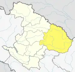 | |
| Rural municipalities | ||
| Former VDCs | ||
List of municipalities and rural municipalities of Nepal | ||