Chiputula
Chiputula, Mzuzu | |
|---|---|
 Chiputula, Mzuzu | |
| Coordinates: 10°53′59″S 34°01′00″E / 10.89972°S 34.01667°E | |
| Country | Malawi |
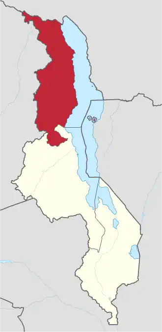
| Region | Northern Region, Malawi |
| Municipality | Mzuzu |
| Established | 1924 |
| Government | |
| • Type | Unitary presidential republic |
| Area | |
• Total | 10.00 km2 (3.86 sq mi) |
| Population (2018) | |
• Total | 12,529 |
| • Density | 1,300/km2 (3,200/sq mi) |
| Racial makeup (2018) | |
| • Black African | 97.2% |
| • Asian | 1.9% |
| • White Malawian | 1.9% |
| First languages (2018) | |
| • Tumbuka | 92.0% |
| • Chewa | 1.7% |
| • Tonga | 1.1% |
| • Other | 3.2% |
| Time zone | UTC+2 (CAT) |
Chiputula is a populated township in Northern Region, Malawi.[1][2] It is located inside Mzuzu city. Its neighbourhood include Luwinga, and Katoto.[3][4]
Geography
Chiputula is located North-East of Mzuzu city.[2]
History
Chiputula got its name from stubborn green grasses that were common in the area.
Institutions
Institutions found in Chiputula include:
- Chiputula C.C.A.P. Church Presbyterian Church[5]
- Chiputula Secondary School
- Chiputula Primary School[1]
References
- ^ a b Agency (MANA), Malawi News (2023-01-17). "Irate learners storm Mzuzu Police Station Malawi 24 | Latest News from Malawi". Malawi 24. Retrieved 2024-04-12.
- ^ a b Zgambo, Mike Lyson (2022-02-20). "Mzuzu Deputy Mayor dumps UTM and joins MCP to work with ruling party Malawi 24 | Latest News from Malawi". Malawi 24. Retrieved 2024-04-12.
- ^ "Chiputula (Ward, Malawi) - Population Statistics, Charts, Map and Location". www.citypopulation.de. Retrieved 2024-04-12.
- ^ Zgambo, Mike Lyson (2020-01-21). "Mzuzu residents forced to pay chiefs to access maize from Admarc Malawi 24 | Latest News from Malawi". Malawi 24. Retrieved 2024-04-12.
- ^ Zeenah, Sibande (2018-06-14). The Religious Geography of Mzuzu City in Northern Malawi. Luviri Press. ISBN 978-99960-981-6-1.
Communities of Mzimba Municipality, Northern Region | |||||||||||||||||||||
|---|---|---|---|---|---|---|---|---|---|---|---|---|---|---|---|---|---|---|---|---|---|
Seat: Mzuzu | |||||||||||||||||||||
| Cities and towns of Mzimba |
|  | |||||||||||||||||||
| Suburbs of Mzuzu |
| ||||||||||||||||||||