Cians
| Cians | |
|---|---|
 Cians Gorge | |
  | |
| Location | |
| Country | France |
| Physical characteristics | |
| Source | |
| • location | Maritime Alps |
| • coordinates | 44°7′29″N 7°0′12″E / 44.12472°N 7.00333°E |
| Mouth | Var |
• coordinates | 43°56′50″N 6°59′17″E / 43.94722°N 6.98806°E |
| Length | 25 km (16 mi) |
| Basin size | 166 km2 (64 sq mi) |
| Basin features | |
| Progression | Var→ Mediterranean Sea |
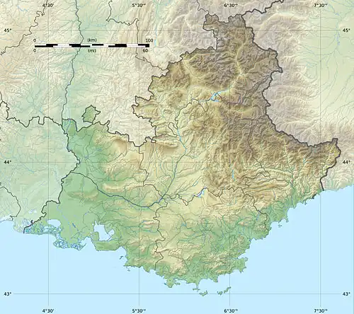
The Cians is a mountain river that flows through the Alpes-Maritimes department of southeastern France. It is 25.3 kilometres (15+3⁄4 miles) long.[1] Its drainage basin is 166 km2 (64 sq mi).[2] Its source is in the mountains north of Beuil, and it flows into the Var in Touët-sur-Var.
The Cians flows through the following communes:
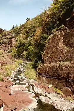
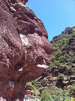
This river runs through a canyon of red shale, named "Gorges du Cians", with formations of eroded rock.
Tributaries
References
- ^ Sandre. "Fiche cours d'eau - Le Cians (Y6110500)".
- ^ Bassin versant : Cians (Le), Observatoire Régional Eau et Milieux Aquatiques en PACA
Wikimedia Commons has media related to Cians.